alb3818722
Western Roman Empire, 3rd Century
| Partager |
|---|
 Pinterest Pinterest |
 Twitter Twitter |
 Facebook Facebook |
 Copier le lien Copier le lien |
 Email Email |
|
Ajouter à une autre Lightbox |
|
Ajouter à une autre Lightbox |


Avez-vous déjà un compte? S'identifier
Vous n'avez pas de compte ? S'inscrire
Acheter cette image

Titre:
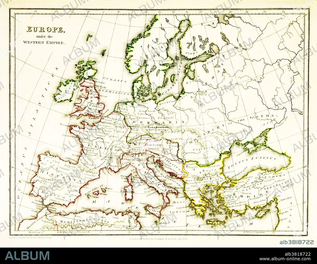
Western Roman Empire, 3rd Century
Légende:
Voir la traduction automatique
A map of Europe, showing the borders of the Western Roman Empire, which reached its greatest extent around 400 CE. A Western Roman Empire existed intermittently in several periods between the 3rd and 5th centuries (285 - 476 CE). Map published in 1831.
Crédit:
Album / Science Source / British Library
Autorisations:
Modèle: Non - Propriété: Non
Questions sur les droits?
Questions sur les droits?
Taille de l'image:
3543 x 2766 px | 28.0 MB
Taille d'impression:
30.0 x 23.4 cm | 11.8 x 9.2 in (300 dpi)
Mots clés:
CARTE • CARTOGRAPHIE • CÉLÈBRE • CELEBRITE • EUROPÉEN • GEOGRAPHIE • ILLUSTRATION • SCIENCE: CARTOGRAPHIE
