alb6386975
Römisches Reich im 3.Jh. / Landkarte
| Partager |
|---|
 Pinterest Pinterest |
 Twitter Twitter |
 Facebook Facebook |
 Copier le lien Copier le lien |
 Email Email |
|
Ajouter à une autre Lightbox |
|
Ajouter à une autre Lightbox |


Avez-vous déjà un compte? S'identifier
Vous n'avez pas de compte ? S'inscrire
Acheter cette image

Titre:
Römisches Reich im 3.Jh. / Landkarte
Légende:
Voir la traduction automatique
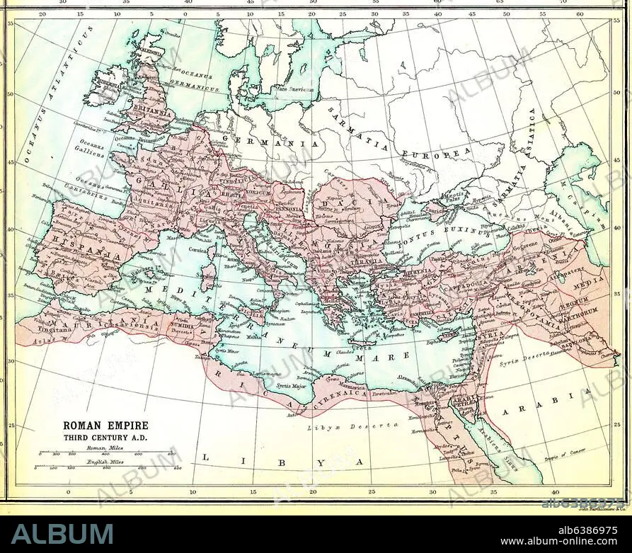
Europa / Landkarten:-"Roman Empire third century A.D.".-(Das Römische Reich im 3.Jh. n.Chr.) Aus: Atlas of the Historical Geography of the Holy Land. Designed and edited by George Adam Smith and prepared unter the direction of J.G. Bartholomew. London, Hodder and Stroughton, 1915.
Projet:
ATLAS OF THE HISTORICAL GEOGRAPHY OF THE HOLY LA
Date de création:
1915
Date de l'événement:
250
Crédit:
Album / akg-images
Autorisations:
Modèle: Non - Propriété: Non
Questions sur les droits?
Questions sur les droits?
Taille de l'image:
2463 x 2007 px | 14.1 MB
Taille d'impression:
20.9 x 17.0 cm | 8.2 x 6.7 in (300 dpi)
Mots clés:
3E SIECLE • ANNEES 1910 • ANNEES DIX • ANTIQUITE • ANTIQUITÉS • ATLAS (LIVRE) • ATLAS OF THE HISTORICAL GEOGRAPHY OF THE HOLY LA • BARTHOLOMEW, J. G. • CARTE (GEOGRAPHIE) • CARTE GEOGRAPHIQUE • CARTE • CARTOGRAPHIE • DESSIN PLANS • DIVERS • EMPIRE ROMAIN • EUROPA (GEOGRAFIA) • EUROPE (CONTINENT) • GEOGRAPHIE • MEDITERRANEE, MER • PERIODE: ROME IMPERIALE • PLAN (CARTOGRAPHIE) • PLANS • ROME, IMPERIALE • SCIENCE: CARTOGRAPHIE • SMITH, GEORGE ADAM • TOPOGRAPHIE • XXE SIECLE
