alb4581575
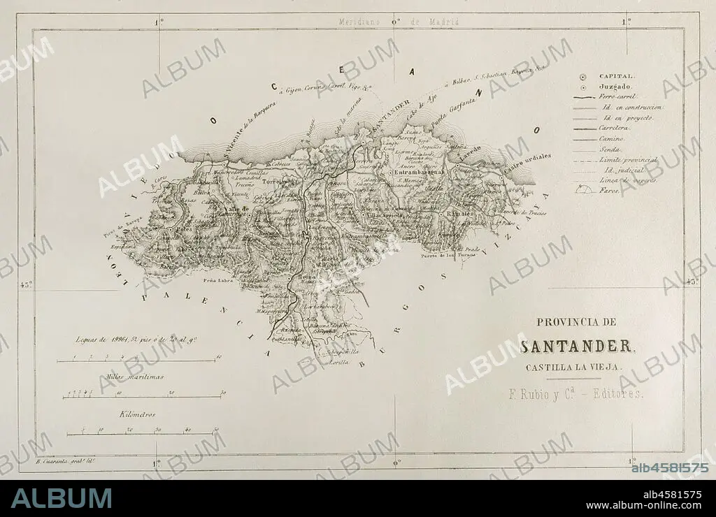
Map of the Santander province, Spain. 19th century. Cr—nica General de Espa–a, Historia Ilustrada y Descriptiva de sus Provincias. Castilla-La Vieja, 1870.
| Partager |
|---|
 Pinterest Pinterest |
 Twitter Twitter |
 Facebook Facebook |
 Copier le lien Copier le lien |
 Email Email |
|
Ajouter à une autre Lightbox |
|
Ajouter à une autre Lightbox |


Avez-vous déjà un compte? S'identifier
Vous n'avez pas de compte ? S'inscrire
Acheter cette image.
Sélectionnez l'usage:

Légende: Voir la traduction automatique
Map of the Santander province, Spain. 19th century. Cr—nica General de Espa–a, Historia Ilustrada y Descriptiva de sus Provincias. Castilla-La Vieja, 1870.
Map of the Santander province, Spain. 19th century. Cr—nica General de Espa–a, Historia Ilustrada y Descriptiva de sus Provincias. Castilla-La Vieja, 1870.
Crédit: Album / Prisma
Autorisations: ? Autorisation de modèle: Non - ? Autorisation de propriété: Non
Questions sur les droits?
Questions sur les droits?
Taille de l'image: 4782 × 3209 px | 43.9 MB
Taille d'impression: 40.5 × 27.2 cm | 1882.7 × 1263.4 in (300 dpi)
Mots clés: 1870 • CARTE (GEOGRAPHIE) • CARTE GEOGRAPHIQUE • CARTE • CARTOGRAPHIE • DESSIN PLANS • ESPAGNOL • EUROPE • EUROPÉEN • FRAVURE • GRAVURE • HISOIRE • HISTOIRE • PLAN (CARTOGRAPHIE) • PLANS • PROVINCE • PROVINS • SCIENCE: CARTOGRAPHIE • XIXE SIÈCLE
