alb4061296
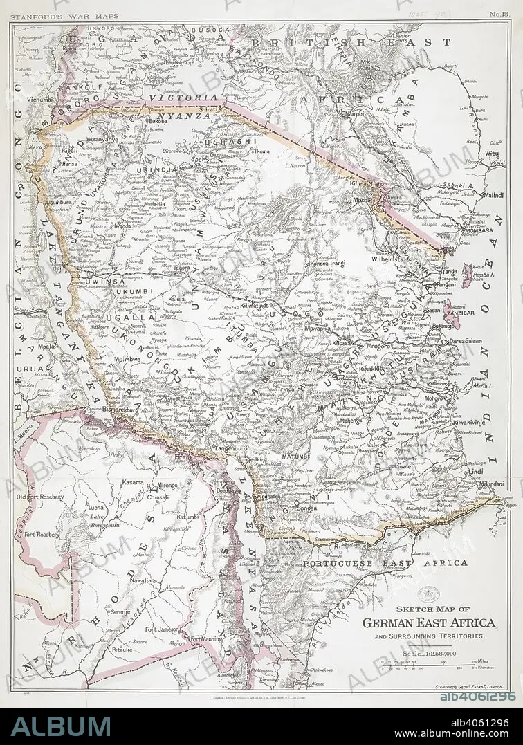
First World War sketch map of German East Africa, 1916. Stanford's War Maps. No. 14. Sketch map of German East Africa and surrounding territories. Scale, 1 : 2,587,000. 27 January 1916. Source: Maps.1035.(90) no.15.
| Partager |
|---|
 Pinterest Pinterest |
 Twitter Twitter |
 Facebook Facebook |
 Copier le lien Copier le lien |
 Email Email |
|
Ajouter à une autre Lightbox |
|
Ajouter à une autre Lightbox |


Avez-vous déjà un compte? S'identifier
Vous n'avez pas de compte ? S'inscrire
Acheter cette image.
Sélectionnez l'usage:

Légende: Voir la traduction automatique
First World War sketch map of German East Africa, 1916. Stanford's War Maps. No. 14. Sketch map of German East Africa and surrounding territories. Scale, 1 : 2,587,000. 27 January 1916. Source: Maps.1035.(90) no.15.
First World War sketch map of German East Africa, 1916. Stanford's War Maps. No. 14. Sketch map of German East Africa and surrounding territories. Scale, 1 : 2,587,000. 27 January 1916. Source: Maps.1035.(90) no.15.
Crédit: Album / British Library
Autorisations: ? Autorisation de modèle: Non - ? Autorisation de propriété: Non
Questions sur les droits?
Questions sur les droits?
Taille de l'image: 6008 × 8136 px | 139.8 MB
Taille d'impression: 50.9 × 68.9 cm | 2365.4 × 3203.1 in (300 dpi)
Mots clés: AFRIQUE • CARTE (GEOGRAPHIE) • CARTE GEOGRAPHIQUE • CARTE • CARTOGRAPHIE • DESSIN PLANS • ÉVÉNEMENT • GRANDE GUERRE • GUERRE 14-18 • GUERRE 1914-1918 • GUERRE MONDIALE I • GUERRE • PLAN (CARTOGRAPHIE) • PLANS • PREMIERE GUERRE MONDIALE (1914-1918) • PREMIERE GUERRE MONDIALE • SCIENCE: CARTOGRAPHIE • XXE SIECLE
