alb4204846
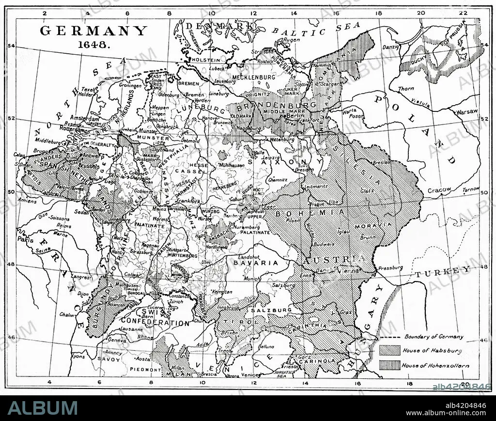
Map of Germany in 1648 after the Peace of Westphalia. From Hutchinson's History of the Nations, published 1915.
| Partager |
|---|
 Pinterest Pinterest |
 Twitter Twitter |
 Facebook Facebook |
 Copier le lien Copier le lien |
 Email Email |
|
Ajouter à une autre Lightbox |
|
Ajouter à une autre Lightbox |


Avez-vous déjà un compte? S'identifier
Vous n'avez pas de compte ? S'inscrire
Acheter cette image.
Sélectionnez l'usage:

Légende:
Voir la traduction automatique
Map of Germany in 1648 after the Peace of Westphalia. From Hutchinson's History of the Nations, published 1915.
Crédit:
Album / Universal Images Group / Universal History Archive
Autorisations:
Taille de l'image:
4774 x 3803 px | 51.9 MB
Taille d'impression:
40.4 x 32.2 cm | 15.9 x 12.7 in (300 dpi)
Mots clés:
17E SIECLE • 17EME S • ALLEMAGNE • ALLEMAND • ALLEMANDE • ARCHIVE • CARTE (GEOGRAPHIE) • CARTE GEOGRAPHIQUE • CARTE • DESSIN PLANS • DIX-SEPTIÈME SIÈCLE • FRAVURE • GEOGRAPHIE • GRAVURE • HISOIRE • HISTOIRE • ILLUSTRATION • PAIX • PLAN (CARTOGRAPHIE) • PLANS • TRAITES DE WESTPHALIE • XVIIE SIECLE
