alb3798297
Second Byrd Antarctic Expedition, 1933-35
| Partager |
|---|
 Pinterest Pinterest |
 Twitter Twitter |
 Facebook Facebook |
 Copier le lien Copier le lien |
 Email Email |
|
Ajouter à une autre Lightbox |
|
Ajouter à une autre Lightbox |


Avez-vous déjà un compte? S'identifier
Vous n'avez pas de compte ? S'inscrire
Acheter cette image

Titre:
Second Byrd Antarctic Expedition, 1933-35
Légende:
Voir la traduction automatique
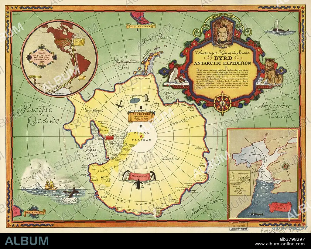
Second Byrd Antarctic Expedition, historical map. This expedition took place between 1933 and 1935, and followed an earlier expedition from 1928 to 1930. It was led by the US polar explorer and naval officer Richard Evelyn Byrd (1888-1957, depicted at upper right). On these, and later expeditions, Byrd used ships, airplanes and dog sleds to establish Antarctic bases. The Byrd expeditions laid the foundations for Operation Highjump, during World War II, and the later Operation Deep Freeze that established permanent bases in Antarctica in the 1950s. The inset at upper left shows the routes taken from the USA and New Zealand. The inset at lower right shows the Bay of Whales and the Ross Ice Shelf.
Crédit:
Album / Science Source / LOC/Geography and Map Division
Autorisations:
Modèle: Non - Propriété: Non
Questions sur les droits?
Questions sur les droits?
Taille de l'image:
7168 x 5376 px | 110.2 MB
Taille d'impression:
60.7 x 45.5 cm | 23.9 x 17.9 in (300 dpi)
Mots clés:
