alb3897622
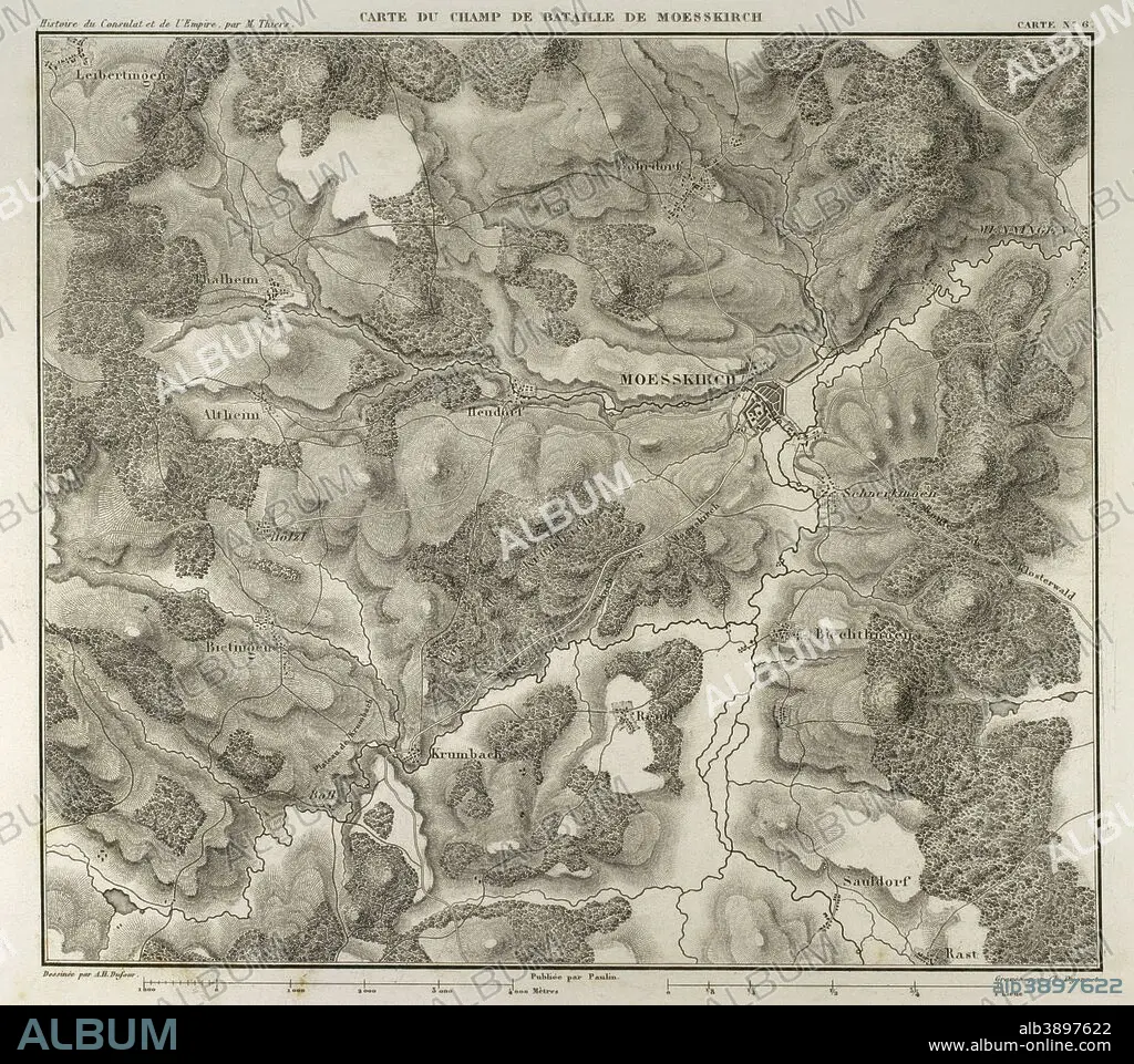
Map of the Battle of Moesskirch, 4th-5th May 1800, between the armies of France and the Holy German Roman Empire. War of the Second Coalition (context of the French Revolutionary Wars, with French victory). Atlas de l'Histoire du Consulat et de l'Empire. History of the Consulate and the Empire of France under Napoleon by Marie Joseph Louis Adolphe Thiers (1797-1877). Drawings by Dufour, engravings by Dyonnet. Edited in Paris, 1864.
| Partager |
|---|
 Pinterest Pinterest |
 Twitter Twitter |
 Facebook Facebook |
 Copier le lien Copier le lien |
 Email Email |
|
Ajouter à une autre Lightbox |
|
Ajouter à une autre Lightbox |


Avez-vous déjà un compte? S'identifier
Vous n'avez pas de compte ? S'inscrire
Acheter cette image.
Sélectionnez l'usage:

Légende:
Voir la traduction automatique
Map of the Battle of Moesskirch, 4th-5th May 1800, between the armies of France and the Holy German Roman Empire. War of the Second Coalition (context of the French Revolutionary Wars, with French victory). Atlas de l'Histoire du Consulat et de l'Empire. History of the Consulate and the Empire of France under Napoleon by Marie Joseph Louis Adolphe Thiers (1797-1877). Drawings by Dufour, engravings by Dyonnet. Edited in Paris, 1864.
Personnalités:
Crédit:
Album / Prisma
Autorisations:
Taille de l'image:
4134 x 3667 px | 43.4 MB
Taille d'impression:
35.0 x 31.0 cm | 13.8 x 12.2 in (300 dpi)
Mots clés:
ANCIEN • ANTIQUE • ARMEE • ARMÉEE • ARMÉES • BASTILLE 1789 • BATAILLE • BATALLE • CARTE (GEOGRAPHIE) • CARTE GEOGRAPHIQUE • CARTE • CARTOGRAPHIE • DESSIN PLANS • DESSIN • DESSINER • EUROPE • EUROPÉEN • FANCE • FRANCE • FRANÇAISE • FRAVURE • GEOGRAPHIE • GRAVURE • GUERRE • HISOIRE • HISTOIRE • HISTORIQUE • MAI • MESSKIRCH • MOTIF • NAPOLÉON IER • PLAN (CARTOGRAPHIE) • PLANS • REVOLUTION FRANCAISE (1789-99) • REVOLUTION FRANCAISE 1789 • SCIENCE: CARTOGRAPHIE • TECHNIQUE: DESSIN • TERRITOIRE • THIERS • XIXE SIÈCLE
