alb4190452
Map of the Waterloo campaign, 1815, Walmer Castle, Kent. Artist: Unknown.
| Partager |
|---|
 Pinterest Pinterest |
 Twitter Twitter |
 Facebook Facebook |
 Copier le lien Copier le lien |
 Email Email |
|
Ajouter à une autre Lightbox |
|
Ajouter à une autre Lightbox |


Avez-vous déjà un compte? S'identifier
Vous n'avez pas de compte ? S'inscrire
Acheter cette image.
Sélectionnez l'usage:

Titre: Map of the Waterloo campaign, 1815, Walmer Castle, Kent. Artist: Unknown.
Légende: Voir la traduction automatique
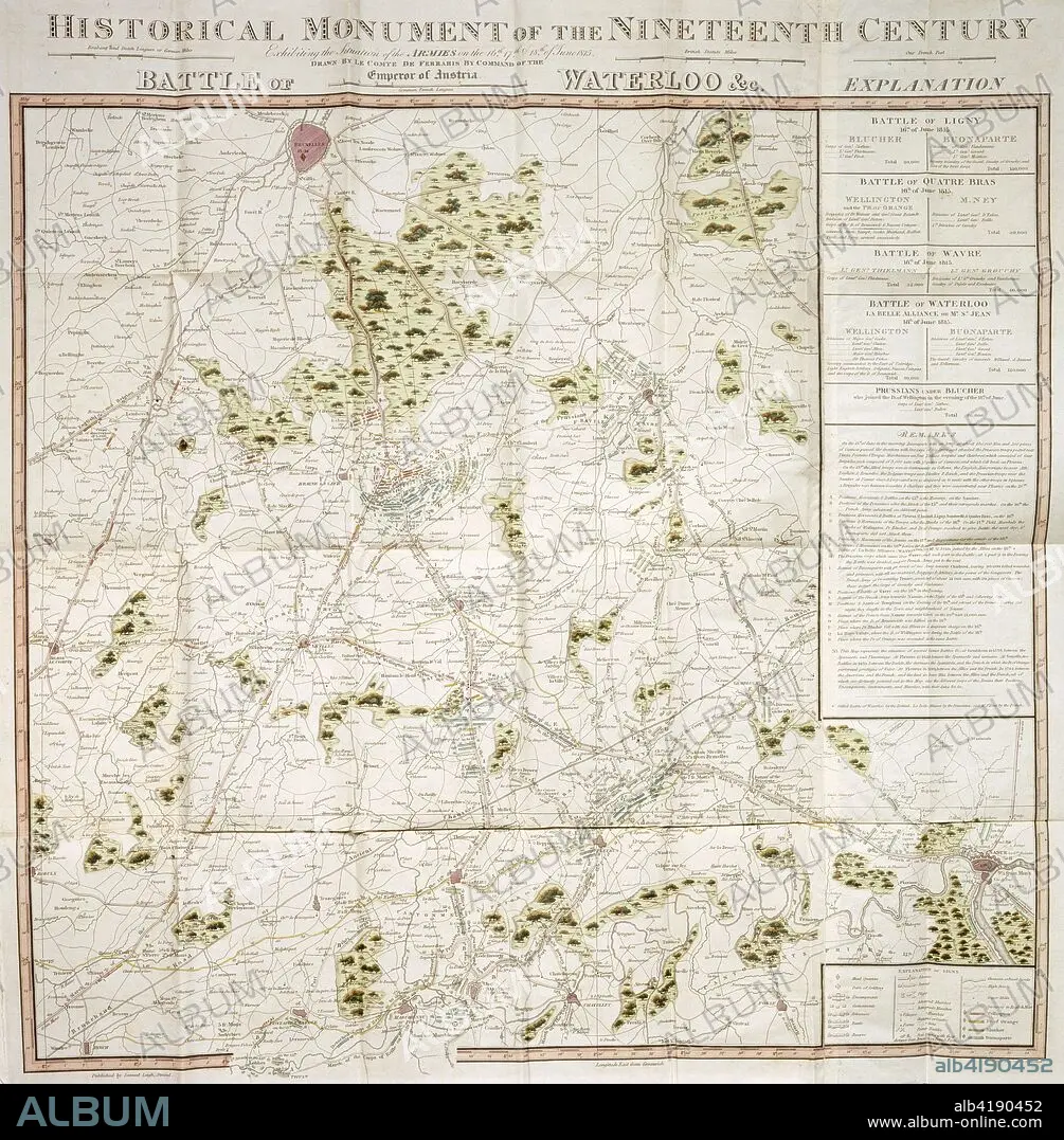
Map of the Waterloo campaign, 1815, Walmer Castle, Kent. Map Exhibiting the Situation of the Armies on the 16, 17 & 18 of June 1815. The Battle of Ligny, Quatre Bras, Waterloo and Wavre.
Map of the Waterloo campaign, 1815, Walmer Castle, Kent. Map Exhibiting the Situation of the Armies on the 16, 17 & 18 of June 1815. The Battle of Ligny, Quatre Bras, Waterloo and Wavre.
Crédit: Album / Heritage Images / Historic England Archive
Autorisations: ? Autorisation de modèle: Non - ? Autorisation de propriété: Non
Questions sur les droits?
Questions sur les droits?
Taille de l'image: 3623 × 3691 px | 38.3 MB
Taille d'impression: 30.7 × 31.3 cm | 1426.4 × 1453.1 in (300 dpi)
Mots clés: ARMEE • ARMÉEE • ARMÉES • BATAILLE DE WATERLOO • BELGIQUE • CAMPAGNES NAPOLEONIENNES • COULEUR • GUERRE NAPOLEONIENNES • GUERRE • GUERRES NAPOLEONIENNES • NAPOLEON, GUERRES • PRUSSIEN
