alb9507328
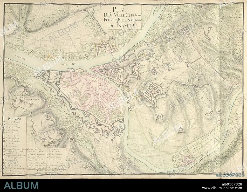
Map of Namur, ca. 1701-1715, Nicolas Suly, 1701 - 1715, Map of the fortifications around the city of Namur with the castle, ca. 1701-1715. Bottom left legend A-Z and 1-13 in French. Part of a collection of drawn plans of fortified towns in the Netherlands and surrounding countries at the time of the War of the Spanish Succession (part B)., draughtsman: Nicolas Suly, (mentioned on object), Netherlands, 1701 - 1715, paper, h 530 mm × w 730 mm.
| Partager |
|---|
 Pinterest Pinterest |
 Twitter Twitter |
 Facebook Facebook |
 Copier le lien Copier le lien |
 Email Email |
|
Ajouter à une autre Lightbox |
|
Ajouter à une autre Lightbox |


Avez-vous déjà un compte? S'identifier
Vous n'avez pas de compte ? S'inscrire
Acheter cette image.
Sélectionnez l'usage:

Légende:
Voir la traduction automatique
Map of Namur, ca. 1701-1715, Nicolas Suly, 1701 - 1715, Map of the fortifications around the city of Namur with the castle, ca. 1701-1715. Bottom left legend A-Z and 1-13 in French. Part of a collection of drawn plans of fortified towns in the Netherlands and surrounding countries at the time of the War of the Spanish Succession (part B)., draughtsman: Nicolas Suly, (mentioned on object), Netherlands, 1701 - 1715, paper, h 530 mm × w 730 mm
Crédit:
Album / quintlox
Autorisations:
Modèle: Non - Propriété: Non
Questions sur les droits?
Questions sur les droits?
Taille de l'image:
6086 x 4418 px | 76.9 MB
Taille d'impression:
51.5 x 37.4 cm | 20.3 x 14.7 in (300 dpi)
Mots clés:
ARCHITECTURE: CHATEAU • CARTE (GEOGRAPHIE) • CARTE GEOGRAPHIQUE • CARTE • CHATEAU • CITE • DESSIN PLANS • DESSINATEUR INDUSTRIEL • FRANÁAIS • FRANÁAISE • FRANÇAIS • GUERRE • OBJET • PAPIER • PLAN (CARTOGRAPHIE) • PLANS • TEMPS • VILE • VILLE
