alb5480506
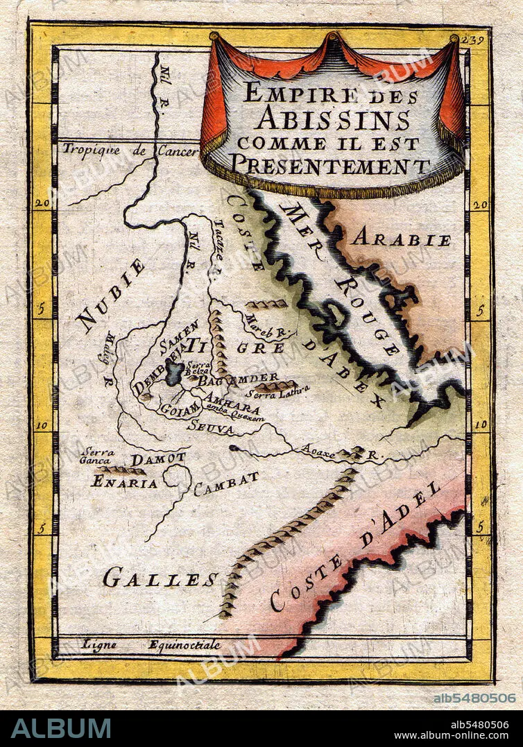
Ethiopia / Sudan / South Sudan: A Map of the Abyssinian Empire,1683
| Partager |
|---|
 Pinterest Pinterest |
 Twitter Twitter |
 Facebook Facebook |
 Copier le lien Copier le lien |
 Email Email |
|
Ajouter à une autre Lightbox |
|
Ajouter à une autre Lightbox |


Avez-vous déjà un compte? S'identifier
Vous n'avez pas de compte ? S'inscrire
Acheter cette image.
Sélectionnez l'usage:

Titre: Ethiopia / Sudan / South Sudan: A Map of the Abyssinian Empire,1683
Légende: Voir la traduction automatique
A French map of the Red Sea and East African Coast dated 1683 and showing parts of Arabia, Nubia, Sudan, South Sudan, Somalia and East Africa.
A French map of the Red Sea and East African Coast dated 1683 and showing parts of Arabia, Nubia, Sudan, South Sudan, Somalia and East Africa.
Crédit: Album / Pictures From History/Universal Images Group
Autorisations: ? Autorisation de modèle: Non - ? Autorisation de propriété: Non
Questions sur les droits?
Questions sur les droits?
Taille de l'image: 3600 × 4887 px | 50.3 MB
Taille d'impression: 30.5 × 41.4 cm | 1417.3 × 1924.0 in (300 dpi)
Mots clés: AFRIQUE • CARTE (GEOGRAPHIE) • CARTE GEOGRAPHIQUE • CARTE • CARTOGRAPHIE • DESSIN PLANS • ETHIOPIE • HISOIRE • HISTOIRE • PLAN (CARTOGRAPHIE) • PLANS • SCIENCE: CARTOGRAPHIE • SOUDAN
