alb1642906
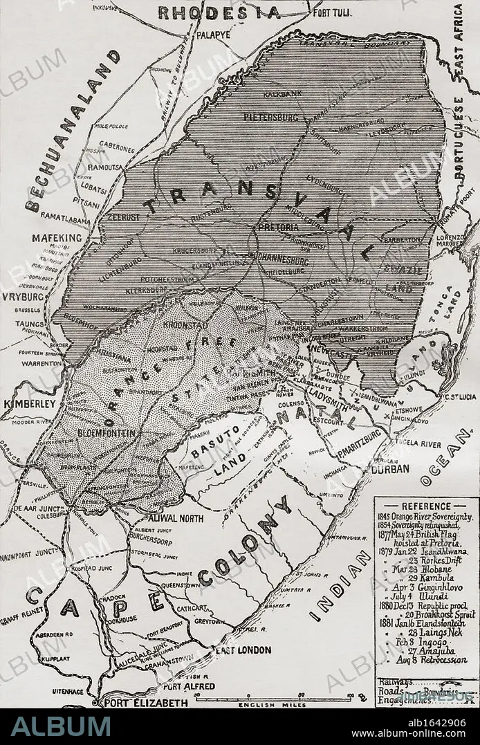
Map of The Boer Republics at the end of the 19th century. From the book South Africa and the Transvaal War, Volume 1 by Louis Creswicke, published 1900.
| Partager |
|---|
 Pinterest Pinterest |
 Twitter Twitter |
 Facebook Facebook |
 Copier le lien Copier le lien |
 Email Email |
|
Ajouter à une autre Lightbox |
|
Ajouter à une autre Lightbox |


Avez-vous déjà un compte? S'identifier
Vous n'avez pas de compte ? S'inscrire
Acheter cette image.
Sélectionnez l'usage:

Légende:
Voir la traduction automatique
Map of The Boer Republics at the end of the 19th century. From the book South Africa and the Transvaal War, Volume 1 by Louis Creswicke, published 1900.
Crédit:
Album / Universal History Archive/Universal Images Group
Autorisations:
Taille de l'image:
3627 x 5350 px | 55.5 MB
Taille d'impression:
30.7 x 45.3 cm | 12.1 x 17.8 in (300 dpi)
Mots clés:
AFRICAIN • AFRICAINE • AFRIQUE • CARTE (GEOGRAPHIE) • CARTE GEOGRAPHIQUE • CARTE • COLONIE • CONFLICTS • CONFLIT • DESSIN PLANS • GUERRE • KEN • ORANGE • PLAN (CARTOGRAPHIE) • PLANS • RÉPUBLIQUE • SUD • XIXE SIÈCLE
