alb1656778
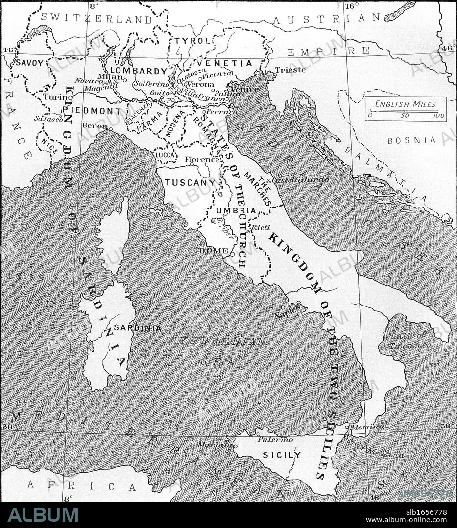
Map of Italy in 1815. From the book Europe in the Nineteenth Century an Outline History, published 1916.
| Partager |
|---|
 Pinterest Pinterest |
 Twitter Twitter |
 Facebook Facebook |
 Copier le lien Copier le lien |
 Email Email |
|
Ajouter à une autre Lightbox |
|
Ajouter à une autre Lightbox |


Avez-vous déjà un compte? S'identifier
Vous n'avez pas de compte ? S'inscrire
Acheter cette image

Légende:
Voir la traduction automatique
Map of Italy in 1815. From the book Europe in the Nineteenth Century an Outline History, published 1916
Crédit:
Album / Universal History Archive/Universal Images Group
Autorisations:
Modèle: Non - Propriété: Non
Questions sur les droits?
Questions sur les droits?
Taille de l'image:
4252 x 4669 px | 56.8 MB
Taille d'impression:
36.0 x 39.5 cm | 14.2 x 15.6 in (300 dpi)
Mots clés:
