alb2219810
Pennsylvania Central-1854 1854
| Partager |
|---|
 Pinterest Pinterest |
 Twitter Twitter |
 Facebook Facebook |
 Copier le lien Copier le lien |
 Email Email |
|
Ajouter à une autre Lightbox |
|
Ajouter à une autre Lightbox |


Avez-vous déjà un compte? S'identifier
Vous n'avez pas de compte ? S'inscrire
Acheter cette image.
Sélectionnez l'usage:

Titre:
Pennsylvania Central-1854 1854
Légende:
Voir la traduction automatique
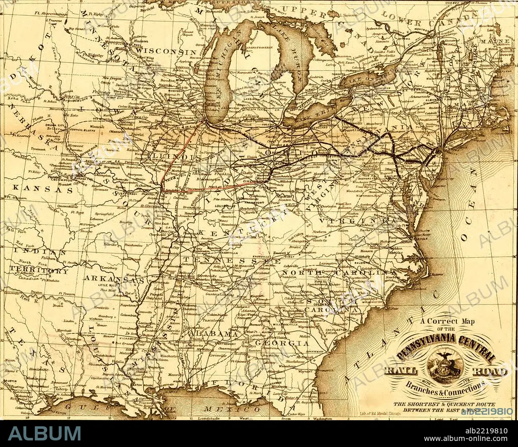
Pennsylvania Central - 1854; map of the eastern United States showing the railroad network and emphasizing the routes between St. Louis and Chicago, and Baltimore, Philadelphia, and New York.
Crédit:
Album / Universal Images Group / Universal History Archive/UIG
Autorisations:
Taille de l'image:
2740 x 2225 px | 17.4 MB
Taille d'impression:
23.2 x 18.8 cm | 9.1 x 7.4 in (300 dpi)
Mots clés:
