alb4552031
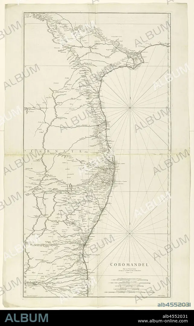
Map of Coromandel, Coromandel / par le Sr d'Anville (title on object), Map of the coast of Coromandel from mo Nega-Patnam to r.b. Narsapur, l.o. scale in French miles, nautical miles, regular Coss, large Coss and miles from Malabar. (Coss is an Indian length measure), maps of separate countries or regions, Coromandel coast, Jean Baptiste Bourguignon d'Anville (mentioned on object), Paris, Jan-1753, paper, engraving, h 960 mm × w 500 mm.
| Partager |
|---|
 Pinterest Pinterest |
 Twitter Twitter |
 Facebook Facebook |
 Copier le lien Copier le lien |
 Email Email |
|
Ajouter à une autre Lightbox |
|
Ajouter à une autre Lightbox |


Avez-vous déjà un compte? S'identifier
Vous n'avez pas de compte ? S'inscrire
Acheter cette image.
Sélectionnez l'usage:

Légende:
Voir la traduction automatique
Map of Coromandel, Coromandel / par le Sr d'Anville (title on object), Map of the coast of Coromandel from mo Nega-Patnam to r.b. Narsapur, l.o. scale in French miles, nautical miles, regular Coss, large Coss and miles from Malabar. (Coss is an Indian length measure), maps of separate countries or regions, Coromandel coast, Jean Baptiste Bourguignon d'Anville (mentioned on object), Paris, Jan-1753, paper, engraving, h 960 mm × w 500 mm
Crédit:
Album / quintlox
Autorisations:
Modèle: Non - Propriété: Non
Questions sur les droits?
Questions sur les droits?
Taille de l'image:
3765 x 6000 px | 64.6 MB
Taille d'impression:
31.9 x 50.8 cm | 12.6 x 20.0 in (300 dpi)
Mots clés:
CARTE (GEOGRAPHIE) • CARTE GEOGRAPHIQUE • CARTE • DESSIN PLANS • FRAVURE • GRAVURE • OBJET • PAPIER • PARIS • PARIS, FRANCE • PLAN (CARTOGRAPHIE) • PLANS • REGIONS
