alb5471796
Thailand: Ko Tarutao Marine National Park, Ko Hin Ngam, striped pebbles
| Partager |
|---|
 Pinterest Pinterest |
 Twitter Twitter |
 Facebook Facebook |
 Copier le lien Copier le lien |
 Email Email |
|
Ajouter à une autre Lightbox |
|
Ajouter à une autre Lightbox |


Avez-vous déjà un compte? S'identifier
Vous n'avez pas de compte ? S'inscrire
Acheter cette image

Titre:
Thailand: Ko Tarutao Marine National Park, Ko Hin Ngam, striped pebbles
Légende:
Voir la traduction automatique
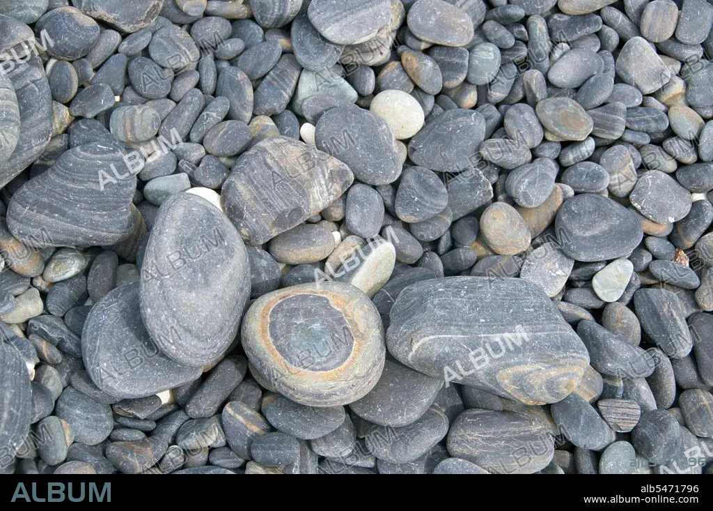
Ko Hin Ngam means ‘Island of Beautiful Stones’ in Thai, and the small beach is covered with smooth black stones in various shapes and covered in distinctive patterns. Ko Tarutao Marine National Park consists of 51 islands in two main groups scattered across the Andaman Sea in southernmost Thailand. Just seven of the islands are of any size, including Ko Tarutao in the east, and Ko Adang-Ko Rawi to the west. Just 5 miles (8km) to the south lies the marine frontier with Malaysia’s celebrated Langkawi Archipelago. Tarutao is world-famous for its pristine diving sites, rich marine life and outstanding natural beauty. Covering a broad area of 575 sq miles (1490 sq km), Tarutao became Thailand’s second national marine park in 1974. Because of the location of the islands so far out to sea, the park is only safely accessible during the northeast monsoon between November and April.
Crédit:
Album / Pictures From History/Universal Images Group
Autorisations:
Modèle: Non - Propriété: Non
Questions sur les droits?
Questions sur les droits?
Taille de l'image:
5100 x 3388 px | 49.4 MB
Taille d'impression:
43.2 x 28.7 cm | 17.0 x 11.3 in (300 dpi)
Mots clés:
ASIE • ASIE, CONTINENT • CONTINENT ASIE • ILE • ÎLES • PARC NATIONAL • PLAGE • THAI • THAILANDE • TOURISME • TOURISTE • TOURISTES
