alb5413502
Guillaume Delisle, French Controlled Louisiana Territory,1718
| Partager |
|---|
 Pinterest Pinterest |
 Twitter Twitter |
 Facebook Facebook |
 Copier le lien Copier le lien |
 Email Email |
|
Ajouter à une autre Lightbox |
|
Ajouter à une autre Lightbox |


Avez-vous déjà un compte? S'identifier
Vous n'avez pas de compte ? S'inscrire
Acheter cette image.
Sélectionnez l'usage:

Titre:
Guillaume Delisle, French Controlled Louisiana Territory,1718
Légende:
Voir la traduction automatique
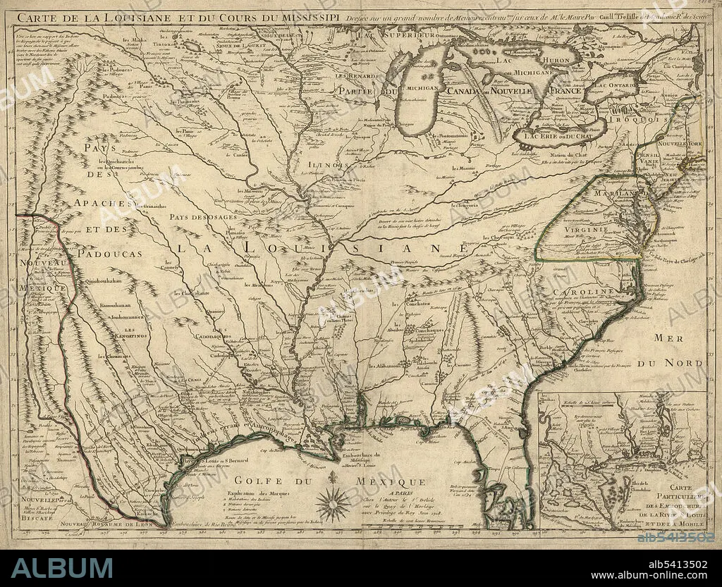
Carte de la Louisiane et du cours du Mississippi: dressée sur un grand nombre de mémoires entrautres sur ceux de Mr. le Maire,1718. The Kingdom of France controlled the Louisiana territory from 1699 until it was ceded to Spain in 1762. The Louisiana territory included land from fifteen present U.S. states and two Canadian provinces. The territory contained land that forms Arkansas, Missouri, Iowa, Oklahoma, Kansas, and Nebraska; the portion of Minnesota west of the Mississippi River; a large portion of North Dakota; a large portion of South Dakota; the northeastern section of New Mexico; the northern portion of Texas; the area of Montana, Wyoming, and Colorado east of the Continental Divide; Louisiana west of the Mississippi River (plus New Orleans); and small portions of land within the present Canadian provinces of Alberta and Saskatchewan. Guillaume Delisle (February 28, 1675 - January 25, 1726) was a French cartographer known for his popular and accurate maps of Europe and the newly explored Americas. His 1718 Carte de la Louisiane is an example of French cartography at its height.
Crédit:
Album / Science Source / LOC/Geography and Map Division
Autorisations:
Modèle: Non - Propriété: Non
Questions sur les droits?
Questions sur les droits?
Taille de l'image:
4275 x 3255 px | 39.8 MB
Taille d'impression:
36.2 x 27.6 cm | 14.2 x 10.8 in (300 dpi)
Mots clés:
