alb9617258
WENCESLAUS HOLLAR. Map of the British Isles and illustrations of 17th century historical events, c1659. Artist: Wenceslaus Hollar.
| Partager |
|---|
 Pinterest Pinterest |
 Twitter Twitter |
 Facebook Facebook |
 Copier le lien Copier le lien |
 Email Email |
|
Ajouter à une autre Lightbox |
|
Ajouter à une autre Lightbox |


Avez-vous déjà un compte? S'identifier
Vous n'avez pas de compte ? S'inscrire
Acheter cette image.
Sélectionnez l'usage:

Auteur:
Titre:
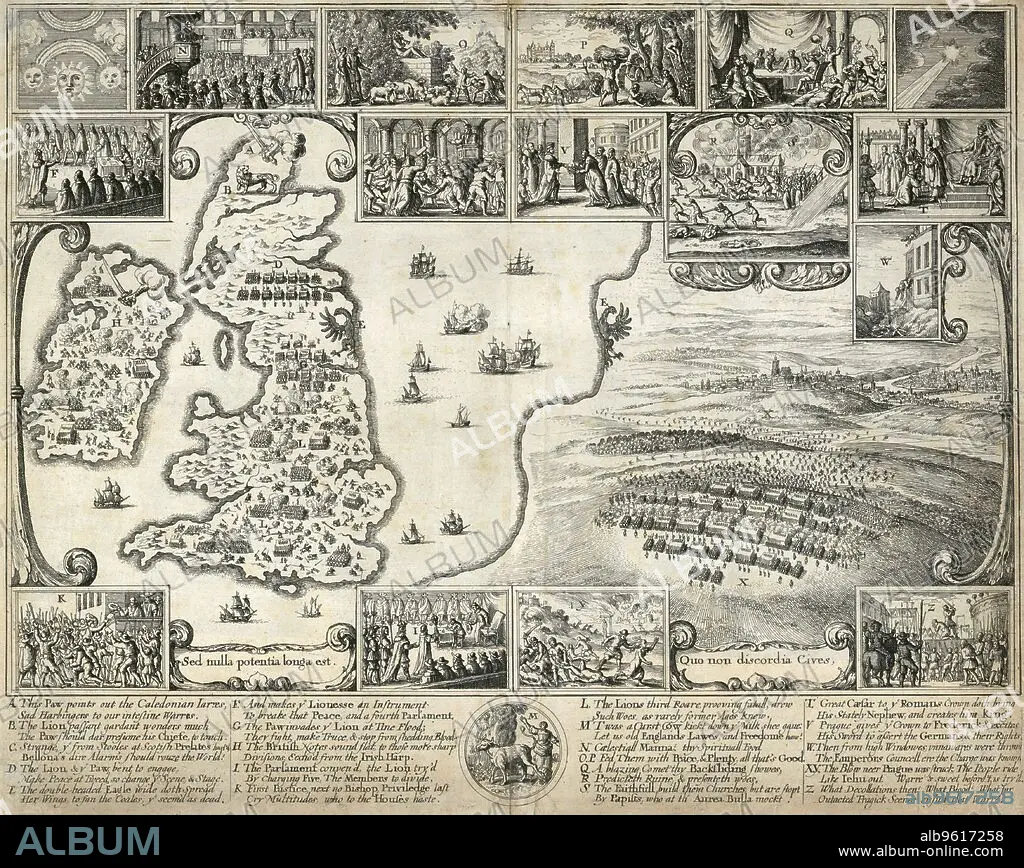
Map of the British Isles and illustrations of 17th century historical events, c1659. Artist: Wenceslaus Hollar.
Légende:
Voir la traduction automatique
Map of the British Isles and illustrations of 17th century historical events, c1659. The large scene depicts the Battle of the White Mountain in Bohemia in 1620 in the the early stages of the Thirty Years War. The smaller compare the events of the English and Bohemian civil wars. From the Mayson Beeton Collection.
Personnalités:
Technique/matériel:
engraving
Crédit:
Album / Historic England Archive/Heritage Images
Autorisations:
Modèle: Non - Propriété: Non
Questions sur les droits?
Questions sur les droits?
Taille de l'image:
4686 x 3731 px | 50.0 MB
Taille d'impression:
39.7 x 31.6 cm | 15.6 x 12.4 in (300 dpi)
Mots clés:
ARMEE • ARMÉEE • ARMÉES • GUERRE • HOLLAR • MONOCHROME • NOIR ET BLANC • PRAGUE • RÉPUBLIQUE TCHÈQUE • SOLDATS • WENCESLAUS HOLLAR
