alb4061169
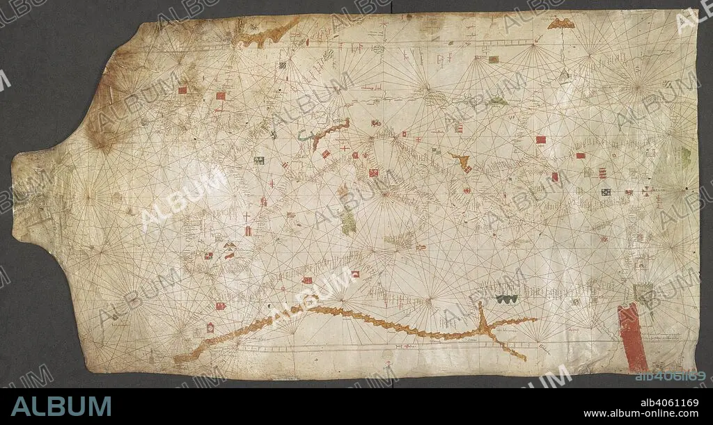
ANGELINO DULCERT. Chart of the Mediterranean Sea, from the Canary Islands to the Red Sea. A church marks the city of Rome in the centre. Italy; late 14th century. Source: Add. 25691. Language: Latin and Italian.
| Partager |
|---|
 Pinterest Pinterest |
 Twitter Twitter |
 Facebook Facebook |
 Copier le lien Copier le lien |
 Email Email |
|
Ajouter à une autre Lightbox |
|
Ajouter à une autre Lightbox |


Avez-vous déjà un compte? S'identifier
Vous n'avez pas de compte ? S'inscrire
Acheter cette image.
Sélectionnez l'usage:

Auteur: ANGELINO DULCERT
Légende: Voir la traduction automatique
Chart of the Mediterranean Sea, from the Canary Islands to the Red Sea. A church marks the city of Rome in the centre. Italy; late 14th century. Source: Add. 25691. Language: Latin and Italian.
Chart of the Mediterranean Sea, from the Canary Islands to the Red Sea. A church marks the city of Rome in the centre. Italy; late 14th century. Source: Add. 25691. Language: Latin and Italian.
Crédit: Album / British Library
Autorisations: ? Autorisation de modèle: Non - ? Autorisation de propriété: Non
Questions sur les droits?
Questions sur les droits?
Taille de l'image: 8911 × 4853 px | 123.7 MB
Taille d'impression: 75.4 × 41.1 cm | 3508.3 × 1910.6 in (300 dpi)
Mots clés: AFRIQUE • CARTE • CARTOGRAPHIE • CITE • CONSTRUCTION RELIGIEUSE • COULEUR • DULCERT, ANGELINO • ECCLESIA • EGLISE • EGLISE, INTERIEUR • ÉGLISES • EUROPE • INTERIEUR: EGLISE • MER • OCEAN ATLANTIQUE • OCEAN • PAYSAGE MARITIME • ROUGE • SCIENCE: CARTOGRAPHIE • TOPOGRAPHIE • VILE • VILLE
