alb1748440
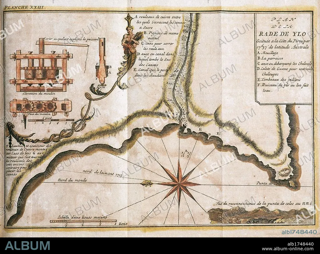
PERU. 18TH CENTURY. MAP OF THE RADA DE YLO (currently ILO), main port located on the Peruvian coast.
 Pinterest
 Twitter
 Facebook
 Copier le lien
 Email
Email


Avez-vous déjà un compte? S'identifier
Vous n'avez pas de compte ? S'inscrire
Acheter cette image

Titre:
PERU. 18TH CENTURY. MAP OF THE RADA DE YLO (currently ILO), main port located on the Peruvian coast.
Légende:
Voir la traduction automatique
SOUTH AMERICA. PERU. 18TH CENTURY. MAP OF THE RADA DE YLO (currently ILO), main port located on the Peruvian coast. Plane of a sugar mill. "RADA DE YLO", at 17.37 southern latitude, on the Pacific coast. French engraving of 1716. Library of Catalonia. Barcelona.
Crédit:
Album / Kurwenal / Prisma
Autorisations:
Modèle: Non - Propriété: Non
Questions sur les droits?
Questions sur les droits?
Taille de l'image:
6201 x 4603 px | 81.7 MB
Taille d'impression:
52.5 x 39.0 cm | 20.7 x 15.3 in (300 dpi)
Mots clés:
18 18E 18EME XVIII XVIIIE XVIIIEME SIECLE • 18E SIECLE • 18EME S • ALIMENT: CANNE A SUCRE • AMÉRIQUE DU SUD • BOCKWINDMUEHLE • CANNE À SUCRE • CANNE • CARTE (GEOGRAPHIE) • CARTE GEOGRAPHIQUE • CARTE • CARTOGRAPHIE • CÔTE • DESSIN PLANS • DIX-HUITIÈME SIÈCLE • EOLIENNE • LITTORAL • MARITIME • MOULIN A VENT • OCEAN PACIFIQUE • PACIFIQUE, OCEAN • PLAN (CARTOGRAPHIE) • PLANS • RADE • SCIENCE: CARTOGRAPHIE • SUCRE, CANNE A • SUD AMERICAIN • VENT, MOULIN A • XVIIIE SIECLE
