alb3932247
Map of the area where the Crimean War was fought in the 1850s, (c1920). Artist: Walter Hutchinson
| Partager |
|---|
 Pinterest Pinterest |
 Twitter Twitter |
 Facebook Facebook |
 Copier le lien Copier le lien |
 Email Email |
|
Ajouter à une autre Lightbox |
|
Ajouter à une autre Lightbox |


Avez-vous déjà un compte? S'identifier
Vous n'avez pas de compte ? S'inscrire
Acheter cette image

Titre:
Map of the area where the Crimean War was fought in the 1850s, (c1920). Artist: Walter Hutchinson
Légende:
Voir la traduction automatique
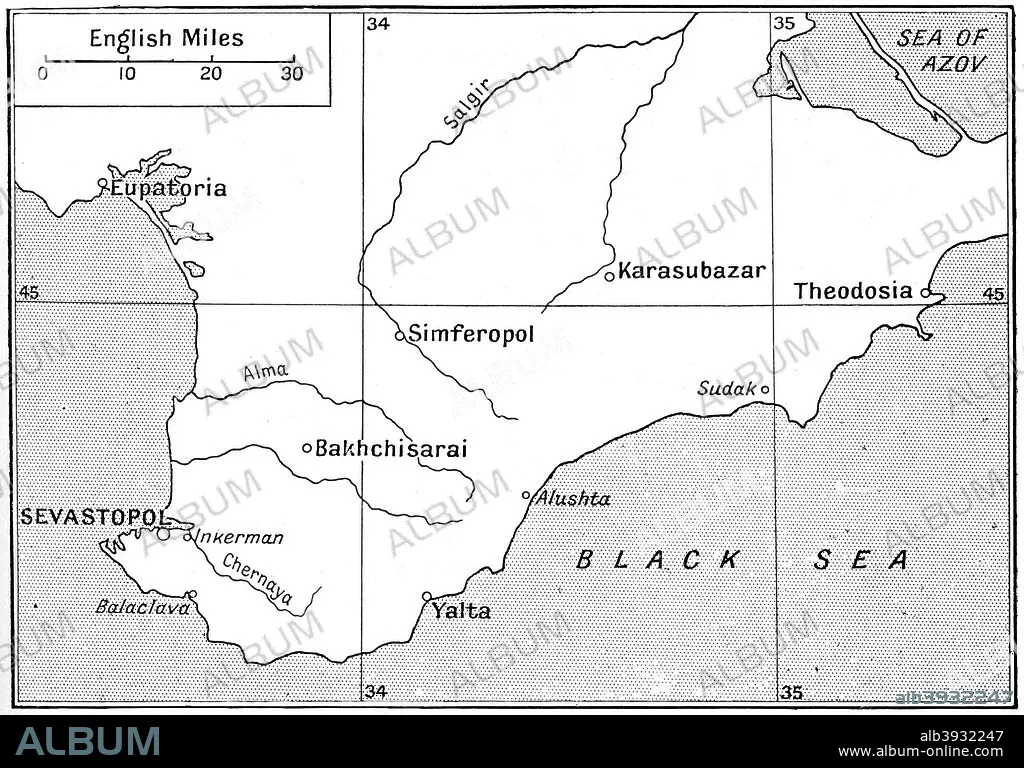
Map of the area where the Crimean War was fought in the 1850s, (c1920). The plan shows the relative positions of the battlefields of Crimea. Illustration from Story of the British Nation, Volume IV, by Walter Hutchinson, (London, c1920s).
Crédit:
Album / The Print Collector / Heritage Images
Autorisations:
Modèle: Non - Propriété: Non
Questions sur les droits?
Questions sur les droits?
Taille de l'image:
4080 x 2848 px | 33.2 MB
Taille d'impression:
34.5 x 24.1 cm | 13.6 x 9.5 in (300 dpi)
Mots clés:
