alb15427722
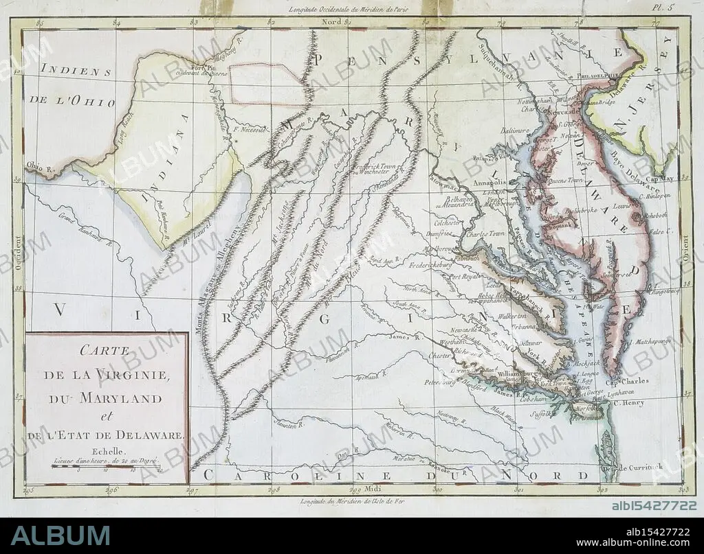
Carte de la Virginie, du Maryland et de l'etat de Delaware., 1782, Date Issued: 1782, (Questionable), Place: Bruxelles :, Publisher: s.n., Delaware, Maps, Early works to 1800, Maryland, Maps, Early works to 1800, Virginia, Maps, Early works to 1800, Extent: 1 map: hand col., 22 x 32 cm., Ancient lands laid bare, Terra firma, ink and pride, History's sweet soil.
| Partager |
|---|
 Pinterest Pinterest |
 Twitter Twitter |
 Facebook Facebook |
 Copier le lien Copier le lien |
 Email Email |
|
Ajouter à une autre Lightbox |
|
Ajouter à une autre Lightbox |


Avez-vous déjà un compte? S'identifier
Vous n'avez pas de compte ? S'inscrire
Acheter cette image.
Sélectionnez l'usage:

Légende:
Voir la traduction automatique
Carte de la Virginie, du Maryland et de l'etat de Delaware., 1782, Date Issued: 1782, (Questionable), Place: Bruxelles :, Publisher: s.n., Delaware, Maps, Early works to 1800, Maryland, Maps, Early works to 1800, Virginia, Maps, Early works to 1800, Extent: 1 map: hand col., 22 x 32 cm., Ancient lands laid bare, Terra firma, ink and pride, History's sweet soil.
Crédit:
Album / quintlox
Autorisations:
Taille de l'image:
4140 x 3049 px | 36.1 MB
Taille d'impression:
35.1 x 25.8 cm | 13.8 x 10.2 in (300 dpi)
Mots clés:
