alb9332496
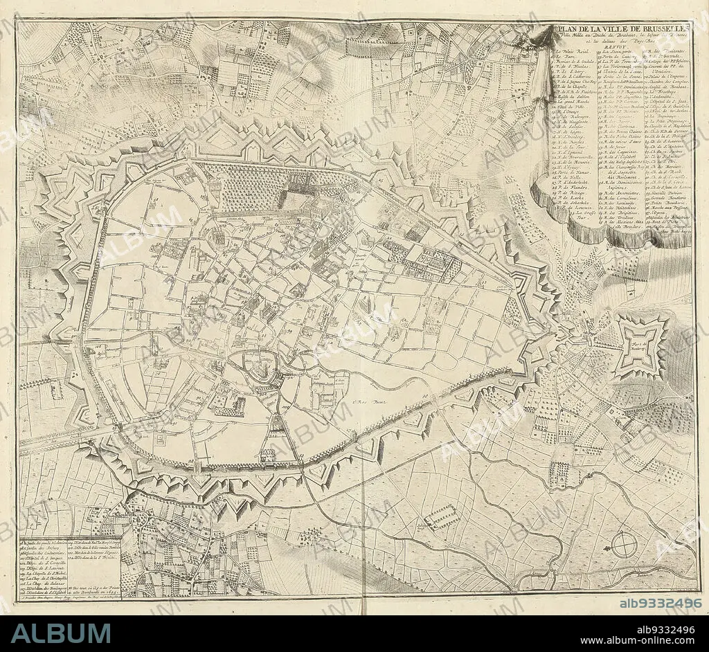
Map of Brussels, 1711, Plan de la ville de Brusseles (title on object), Map of Brussels, 1711. Top right legend 1-100, bottom left continuation 101-114. Part of a bundled collection of plans of battles and cities renowned in the War of the Spanish Succession., print maker: J.G. Harrewijn (II) (mentioned on object), publisher: Eugene Henry Fricx (mentioned on object), Brussels, 1711, paper, etching, engraving, height 510 mm × width 600 mm.
| Partager |
|---|
 Pinterest Pinterest |
 Twitter Twitter |
 Facebook Facebook |
 Copier le lien Copier le lien |
 Email Email |
|
Ajouter à une autre Lightbox |
|
Ajouter à une autre Lightbox |


Avez-vous déjà un compte? S'identifier
Vous n'avez pas de compte ? S'inscrire
Acheter cette image.
Sélectionnez l'usage:

Légende:
Voir la traduction automatique
Map of Brussels, 1711, Plan de la ville de Brusseles (title on object), Map of Brussels, 1711. Top right legend 1-100, bottom left continuation 101-114. Part of a bundled collection of plans of battles and cities renowned in the War of the Spanish Succession., print maker: J.G. Harrewijn (II) (mentioned on object), publisher: Eugene Henry Fricx (mentioned on object), Brussels, 1711, paper, etching, engraving, height 510 mm × width 600 mm
Crédit:
Album / quintlox
Autorisations:
Taille de l'image:
4912 x 4266 px | 60.0 MB
Taille d'impression:
41.6 x 36.1 cm | 16.4 x 14.2 in (300 dpi)
Mots clés:
BRUXELLES • CARTE (GEOGRAPHIE) • CARTE GEOGRAPHIQUE • CARTE • DESSIN PLANS • FRAVURE • GRAVURE • GUERRE • PAPIER • PLAN (CARTOGRAPHIE) • PLANS
