alb5410307
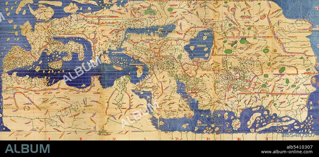
Tabula Rogeriana, Upside-Down with North Up, Al-Idrisi,1154
| Partager |
|---|
 Pinterest Pinterest |
 Twitter Twitter |
 Facebook Facebook |
 Copier le lien Copier le lien |
 Email Email |
|
Ajouter à une autre Lightbox |
|
Ajouter à une autre Lightbox |


Avez-vous déjà un compte? S'identifier
Vous n'avez pas de compte ? S'inscrire
Acheter cette image.
Sélectionnez l'usage:

Titre:
Tabula Rogeriana, Upside-Down with North Up, Al-Idrisi,1154
Légende:
Traduction automatique: La Tabula Rogeriana, dessinée par Al-Idrisi pour Roger II de Sicile en 1154, était l'une des cartes du monde les plus avancées de son époque, montrant l'Europe, l'Asie et une partie de l'Afrique. Le voici orienté à l'envers avec le nord en haut. Muhammad al-Idrisi était un géographe, cartographe et égyptologue arabe musulman qui vivait à Palerme, en Sicile, à la cour du roi Roger II.
The Tabula Rogeriana, drawn by Al-Idrisi for Roger II of Sicily in 1154, was one of the most advanced world maps of its era, showing Europe, Asia, and part of Africa. Here is it oriented upside-down with north up. Muhammad al-Idrisi was an Arab Muslim geographer, cartographer and Egyptologist who lived in Palermo, Sicily at the court of King Roger II.
Crédit:
Album / Science Source
Autorisations:
Modèle: Non - Propriété: Non
Questions sur les droits?
Questions sur les droits?
Taille de l'image:
8100 x 3567 px | 82.7 MB
Taille d'impression:
68.6 x 30.2 cm | 27.0 x 11.9 in (300 dpi)
Mots clés:
