alb3549693
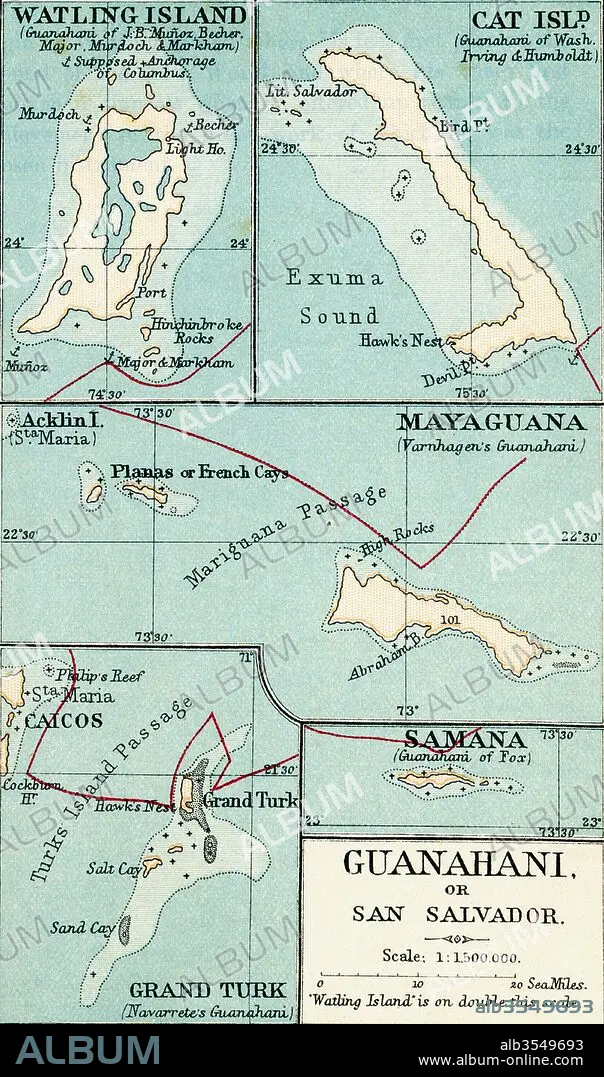
Map of Guanahani or San Salvador showing Watling Island where Christopher Columbus made landfall in 1492
| Partager |
|---|
 Pinterest Pinterest |
 Twitter Twitter |
 Facebook Facebook |
 Copier le lien Copier le lien |
 Email Email |
|
Ajouter à une autre Lightbox |
|
Ajouter à une autre Lightbox |


Avez-vous déjà un compte? S'identifier
Vous n'avez pas de compte ? S'inscrire
Acheter cette image.
Sélectionnez l'usage:

Titre: Map of Guanahani or San Salvador showing Watling Island where Christopher Columbus made landfall in 1492
Légende: Voir la traduction automatique
Map of Guanahani or San Salvador showing Watling Island where Christopher Columbus made landfall in 1492. From the book Life of Christopher Columbus by Clements R. Markham published 1892.
Map of Guanahani or San Salvador showing Watling Island where Christopher Columbus made landfall in 1492. From the book Life of Christopher Columbus by Clements R. Markham published 1892.
Crédit: Album / Universal Images Group / Universal History Archive
Autorisations: ? Autorisation de modèle: Non - ? Autorisation de propriété: Non
Questions sur les droits?
Questions sur les droits?
Taille de l'image: 3220 × 5457 px | 50.3 MB
Taille d'impression: 27.3 × 46.2 cm | 1267.7 × 2148.4 in (300 dpi)
Mots clés: ANIMAL: CHAT • CARTE (GEOGRAPHIE) • CARTE GEOGRAPHIQUE • CARTE • CARTOGRAPHIE • CHAT • DESSIN PLANS • GEOGRAPHIE • ILE • ÎLES • MONDE • PLAN (CARTOGRAPHIE) • PLANS • SCIENCE: CARTOGRAPHIE • TURC • TURCS • TURQUE
