alb9356864
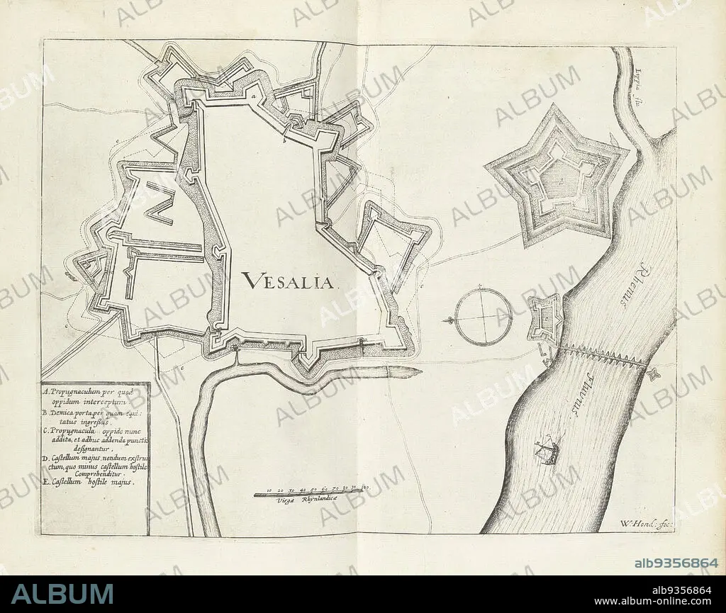
Map of Wesel, 1629, Vesalia (title on object), Map of the city of Wesel, taken by the State army under Frederick Henry, August 19, 1629., print maker: Willem Hondius (mentioned on object), Northern Netherlands, 1629 - 1631, paper, engraving, height 236 mm × width 305 mm.
| Partager |
|---|
 Pinterest Pinterest |
 Twitter Twitter |
 Facebook Facebook |
 Copier le lien Copier le lien |
 Email Email |
|
Ajouter à une autre Lightbox |
|
Ajouter à une autre Lightbox |


Avez-vous déjà un compte? S'identifier
Vous n'avez pas de compte ? S'inscrire
Acheter cette image

Légende:
Voir la traduction automatique
Map of Wesel, 1629, Vesalia (title on object), Map of the city of Wesel, taken by the State army under Frederick Henry, August 19, 1629., print maker: Willem Hondius (mentioned on object), Northern Netherlands, 1629 - 1631, paper, engraving, height 236 mm × width 305 mm
Crédit:
Album / quintlox
Autorisations:
Modèle: Non - Propriété: Non
Questions sur les droits?
Questions sur les droits?
Taille de l'image:
4419 x 3502 px | 44.3 MB
Taille d'impression:
37.4 x 29.7 cm | 14.7 x 11.7 in (300 dpi)
Mots clés:
CARTE (GEOGRAPHIE) • CARTE GEOGRAPHIQUE • CARTE • CITE • DESSIN PLANS • FRAVURE • GRAVURE • PAPIER • PLAN (CARTOGRAPHIE) • PLANS • VILE • VILLE
