alb3980258
Map of London, 1560. Artist: George Vertue
| Partager |
|---|
 Pinterest Pinterest |
 Twitter Twitter |
 Facebook Facebook |
 Copier le lien Copier le lien |
 Email Email |
|
Ajouter à une autre Lightbox |
|
Ajouter à une autre Lightbox |


Avez-vous déjà un compte? S'identifier
Vous n'avez pas de compte ? S'inscrire
Acheter cette image.
Sélectionnez l'usage:

Titre: Map of London, 1560. Artist: George Vertue
Légende: Voir la traduction automatique
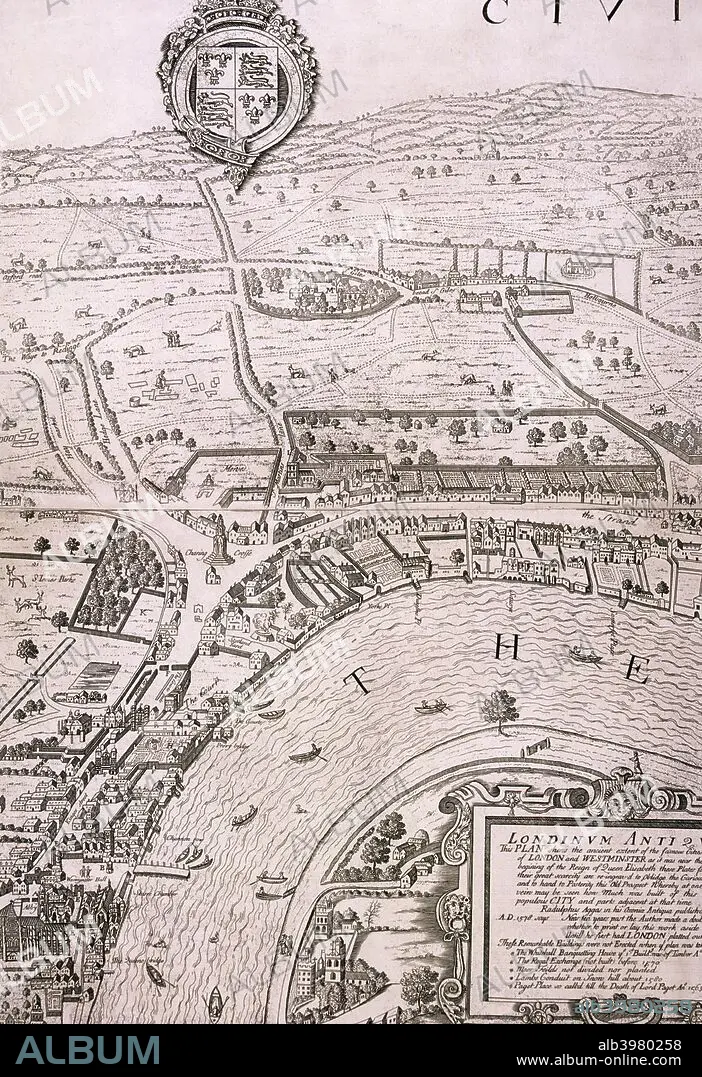
Map of London in the year 1560; showing the area between Westminster and the Strand, with Lambeth to the south of the River Thames and the Tudor royal arms at the top.
Map of London in the year 1560; showing the area between Westminster and the Strand, with Lambeth to the south of the River Thames and the Tudor royal arms at the top.
Personnalités: GEORGE VERTUE
Crédit: Album / The London Archives (City of London)/Heritage Images
Autorisations: ? Autorisation de modèle: Non - ? Autorisation de propriété: Non
Questions sur les droits?
Questions sur les droits?
Taille de l'image: 3461 × 5047 px | 50.0 MB
Taille d'impression: 29.3 × 42.7 cm | 1362.6 × 1987.0 in (300 dpi)
Mots clés: 16E SIECLE • 16EME S • ANGLETERRE • FLEUVE TAMISE • GEOGRAPHIE • GEORGE VERTUE • MONOCHROME • NOIR ET BLANC • ROYAUTÉ • SEIZIÈME SIÈCLE • TAMISE • TAMISE, FLEUVE • TUDOR • WESTMINSTER • XVIE SIECLE
