alb3548663
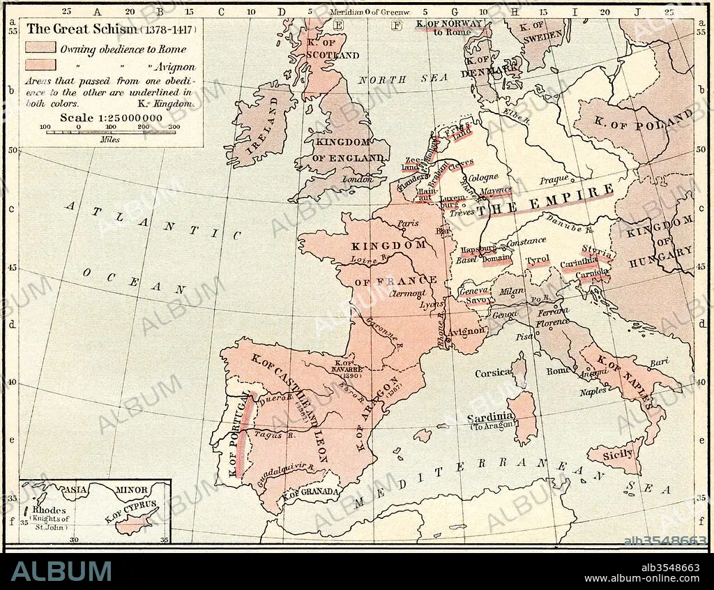
Map of The Western Schism, or Papal or Great Schism, 1378-1417, showing allegiance of European countries
| Partager |
|---|
 Pinterest Pinterest |
 Twitter Twitter |
 Facebook Facebook |
 Copier le lien Copier le lien |
 Email Email |
|
Ajouter à une autre Lightbox |
|
Ajouter à une autre Lightbox |


Avez-vous déjà un compte? S'identifier
Vous n'avez pas de compte ? S'inscrire
Acheter cette image.
Sélectionnez l'usage:

Titre:
Map of The Western Schism, or Papal or Great Schism, 1378-1417, showing allegiance of European countries
Légende:
Voir la traduction automatique
Map of The Western Schism, or Papal or Great Schism, 1378 - 1417, showing allegiance of European countries. From Historical Atlas, published 1923.
Crédit:
Album / Universal Images Group / Universal History Archive
Autorisations:
Modèle: Non - Propriété: Non
Questions sur les droits?
Questions sur les droits?
Taille de l'image:
4883 x 3783 px | 52.8 MB
Taille d'impression:
41.3 x 32.0 cm | 16.3 x 12.6 in (300 dpi)
Mots clés:
14 14E 14EME XIV XIVE XIVEME SIECLE • 14E SIECLE • 14EME S • 15 15E 15EME XV XVE XVEME SIECLE • 15E SIECLE • 15EME S • CARTE (GEOGRAPHIE) • CARTE GEOGRAPHIQUE • CARTE • CATHOLICISME • CATHOLIQUE (ADJECTIF) • CATHOLIQUE (PERSONNE) • CATHOLIQUE • DESSIN PLANS • ECCLESIA • EGLISE • EGLISE, INTERIEUR • ÉGLISES • EUROPÉEN • GEOGRAPHIE • HISOIRE • HISTOIRE • INTERIEUR: EGLISE • OCCIDENTAL • OCCIDENTAUX • PAYS • PLAN (CARTOGRAPHIE) • PLANS • QUATORZIÈME SIÈCLE • QUINZIÈME SIÈCLE • SCHISME • WESTERN • XIVE SIECLE • XVE SIECLE
