alb4478645
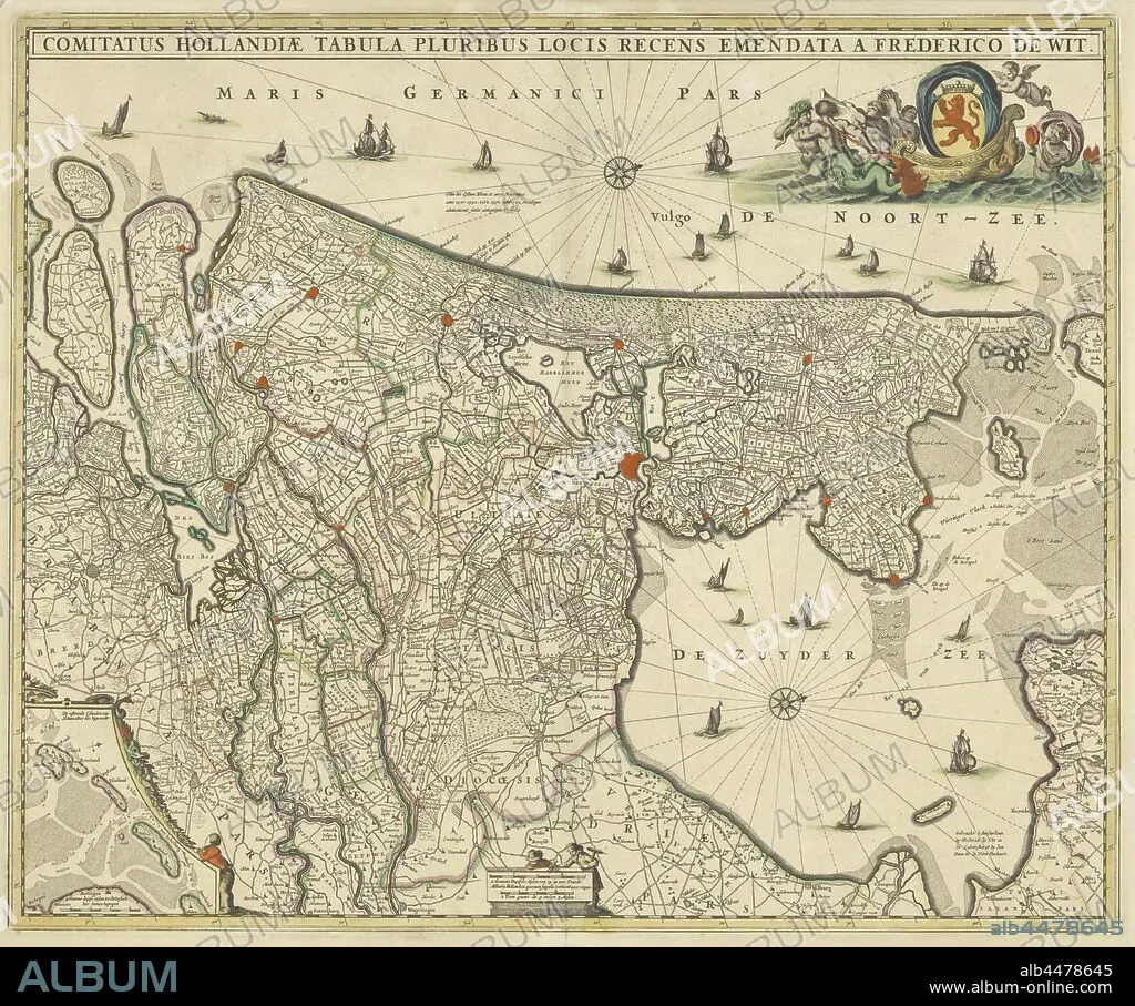
Map of county Holland, Comitatus Hollandiae tabula pluribus locis recens emendata (title on object), Map of the county of Holland on a scale of 1: 300 000, north on the right. Above right the weapon of Holland on a boat pulled by sea creatures. Bottom left a deployment with the Wadden Islands Texel, Vlieland, Terschelling and part of Ameland, maps of separate countries or regions, Holland, Noord-Holland, Zuid-Holland, Frederik de Wit (mentioned on object), c. 1670, paper, engraving, h 463 mm × w 563 mm.
| Partager |
|---|
 Pinterest Pinterest |
 Twitter Twitter |
 Facebook Facebook |
 Copier le lien Copier le lien |
 Email Email |
|
Ajouter à une autre Lightbox |
|
Ajouter à une autre Lightbox |


Avez-vous déjà un compte? S'identifier
Vous n'avez pas de compte ? S'inscrire
Acheter cette image

Légende:
Voir la traduction automatique
Map of county Holland, Comitatus Hollandiae tabula pluribus locis recens emendata (title on object), Map of the county of Holland on a scale of 1: 300 000, north on the right. Above right the weapon of Holland on a boat pulled by sea creatures. Bottom left a deployment with the Wadden Islands Texel, Vlieland, Terschelling and part of Ameland, maps of separate countries or regions, Holland, Noord-Holland, Zuid-Holland, Frederik de Wit (mentioned on object), c. 1670, paper, engraving, h 463 mm × w 563 mm
Crédit:
Album / quintlox
Autorisations:
Modèle: Non - Propriété: Non
Questions sur les droits?
Questions sur les droits?
Taille de l'image:
5359 x 4468 px | 68.5 MB
Taille d'impression:
45.4 x 37.8 cm | 17.9 x 14.9 in (300 dpi)
Mots clés:
ARME • ARMES • CARTE (GEOGRAPHIE) • CARTE GEOGRAPHIQUE • CARTE • DESSIN PLANS • FRAVURE • GRAVURE • HOLLANDE • NORD • OBJET • PAPIER • PAYS BAS • PLAN (CARTOGRAPHIE) • PLANS • REGIONS
