alb3820739
Star Map, Astronomicon Caesareum, 1540
| Partager |
|---|
 Pinterest Pinterest |
 Twitter Twitter |
 Facebook Facebook |
 Copier le lien Copier le lien |
 Email Email |
|
Ajouter à une autre Lightbox |
|
Ajouter à une autre Lightbox |


Avez-vous déjà un compte? S'identifier
Vous n'avez pas de compte ? S'inscrire
Acheter cette image.
Sélectionnez l'usage:

Titre: Star Map, Astronomicon Caesareum, 1540
Légende: Voir la traduction automatique
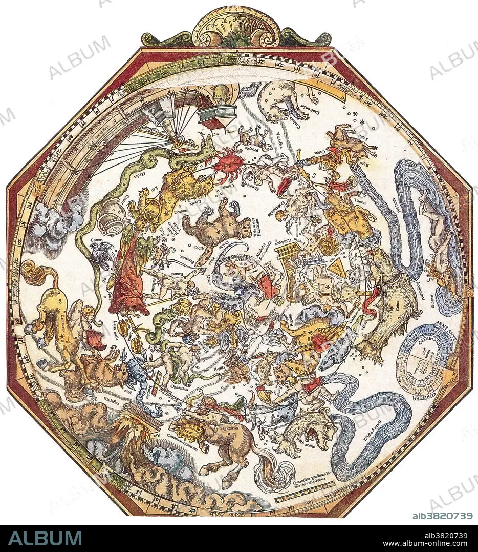
A star chart or star map is a map of the night sky. Astronomers divide these into grids to use them more easily. They are used to identify and locate astronomical objects such as stars, constellations and galaxies. They have been used for human navigation since time immemorial. Petrus Apianus (April 16, 1495 - April 21, 1552) was a German humanist, known for his works in mathematics, astronomy and cartography. In 1524 he produced his Cosmographicus liber, a respected work on astronomy and navigation that was to see at least 30 reprints in 14 languages. In 1540, he printed the Astronomicum Caesareum, dedicated to Charles V who appointed him his court mathematician. He designed sundials, published manuals for astronomical instruments and crafted volvelles (Apian wheels), measuring instruments useful for calculating time and distance for astronomical and astrological applications. He died in 1552 at the age of 57.
A star chart or star map is a map of the night sky. Astronomers divide these into grids to use them more easily. They are used to identify and locate astronomical objects such as stars, constellations and galaxies. They have been used for human navigation since time immemorial. Petrus Apianus (April 16, 1495 - April 21, 1552) was a German humanist, known for his works in mathematics, astronomy and cartography. In 1524 he produced his Cosmographicus liber, a respected work on astronomy and navigation that was to see at least 30 reprints in 14 languages. In 1540, he printed the Astronomicum Caesareum, dedicated to Charles V who appointed him his court mathematician. He designed sundials, published manuals for astronomical instruments and crafted volvelles (Apian wheels), measuring instruments useful for calculating time and distance for astronomical and astrological applications. He died in 1552 at the age of 57.
Crédit: Album / Science Source / New York Public Library
Autorisations: ? Autorisation de modèle: Non - ? Autorisation de propriété: Non
Questions sur les droits?
Questions sur les droits?
Taille de l'image: 3300 × 3617 px | 34.1 MB
Taille d'impression: 27.9 × 30.6 cm | 1299.2 × 1424.0 in (300 dpi)
Mots clés: 16E SIECLE • 16EME S • ASTROLOGIE ZODIAQUE • ASTROLOGIE • ASTRONOMIE • BELIER (ZODIAQUE) • CANCER • CAPRICORNE (ZODIAQUE) • CÉLÈBRE • CELEBRITE • POISSONS (ZODIAQUE) • SCIENCE: ASTROLOGIE • SCIENCE: ASTRONOMIE • SEIZIÈME SIÈCLE • XVIE SIECLE • ZODIAQUE • ZODIAQUE, ASTROLOGIE
