alb3178090
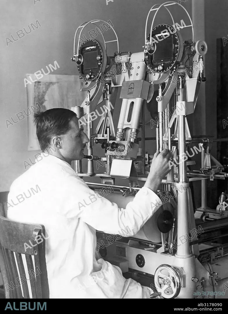
Washington, D. C.: October 13, 1927 Heinz Gruner of the U. S. Geological Survey doing experimental trials of an aerocartograph to do topographic mapping with aerial images © Underwood Archives / The Image Works
| Partager |
|---|
 Pinterest Pinterest |
 Twitter Twitter |
 Facebook Facebook |
 Copier le lien Copier le lien |
 Email Email |
|
Ajouter à une autre Lightbox |
|
Ajouter à une autre Lightbox |


Avez-vous déjà un compte? S'identifier
Vous n'avez pas de compte ? S'inscrire
Acheter cette image.
Sélectionnez l'usage:

Titre: Washington, D. C.: October 13, 1927 Heinz Gruner of the U. S. Geological Survey doing experimental trials of an aerocartograph to do topographic mapping with aerial images © Underwood Archives / The Image Works
Légende: Voir la traduction automatique
Washington, D.C.: October 13, 1927 Heinz Gruner of the U.S. Geological Survey doing experimental trials of an aerocartograph to do topographic mapping with aerial images © Underwood Archives / The Image Works
Washington, D.C.: October 13, 1927 Heinz Gruner of the U.S. Geological Survey doing experimental trials of an aerocartograph to do topographic mapping with aerial images © Underwood Archives / The Image Works
Crédit: Album / Universal Images Group
Autorisations: ? Autorisation de modèle: Non - ? Autorisation de propriété: Non
Questions sur les droits?
Questions sur les droits?
Taille de l'image: 3894 × 5100 px | 56.8 MB
Taille d'impression: 33.0 × 43.2 cm | 1533.1 × 2007.9 in (300 dpi)
Mots clés: ADULTE • ALCOOL • ALIMENT • ALIMENTS • AMERICAIN (ETATS-UNIS) • AMERICAIN (USA) • ANNEES 1910 • ANNEES 1920 • ANNEES VINGT • ASSIS • BOIRE • BOISSON • CARTE • CARTOGRAPHIE • CHAISE • COURS • CULTURE • DÉCOUVERTE • DENREE ALIMENTAIRE • ÉCOLES • EDUCATION ECOLE • EDUCATION • ÉDUQUER • ENSEIGNANT • ENSEIGNEMENT • ÉTAS UNIS • ÉTAS-UNIS • ETATS UNIS • ETATS-UNIS • ETUDE • FORMATION • HOMME • INDUSTRIE • INDUSTRIE: USINES • INGÉNIERIE • INGENIEUR • INSTITUTEURS • INSTRUCTION (ENSEIGNEMENT) • INSTRUCTION • JOB • MACHINE • MACHINERIE • MAITRES ECOLE • MANGER • MILLESIME • NOURRITURE • OCCUPATION • PEDAGOGIE • POSITION ASSISE • PROFESSEUR • RECHERCHE • REPAS • ROUE • ROUES • SCIENCE: CARTOGRAPHIE • STUDIO • TECHNOLOGIE • TRANSPORT ROUES • U. S. A. • USINE • USINES • VERTICALE • ŽTATS-UNIS
