alb2603218
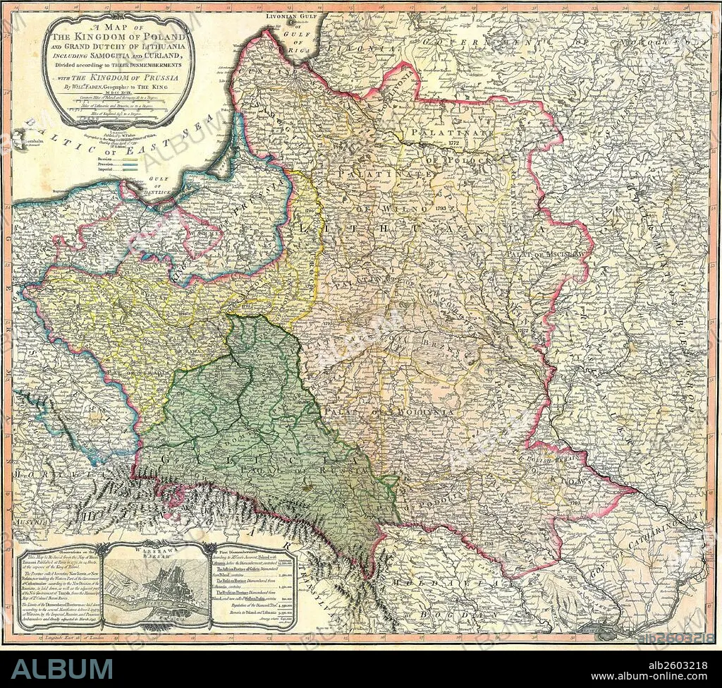
Map showing the partition of the Kingdom of Poland and the Grand Duchy of Lithuania.
| Partager |
|---|
 Pinterest Pinterest |
 Twitter Twitter |
 Facebook Facebook |
 Copier le lien Copier le lien |
 Email Email |
|
Ajouter à une autre Lightbox |
|
Ajouter à une autre Lightbox |


Avez-vous déjà un compte? S'identifier
Vous n'avez pas de compte ? S'inscrire
Acheter cette image

Titre:
Map showing the partition of the Kingdom of Poland and the Grand Duchy of Lithuania.
Légende:
Voir la traduction automatique
Map showing the partition of the Kingdom of Poland and the Grand Duchy of Lithuania, 1799.
Crédit:
Album / Universal Images Group / Universal History Archive
Autorisations:
Modèle: Non - Propriété: Non
Questions sur les droits?
Questions sur les droits?
Taille de l'image:
4827 x 4344 px | 60.0 MB
Taille d'impression:
40.9 x 36.8 cm | 16.1 x 14.5 in (300 dpi)
Mots clés:
