alb4059428
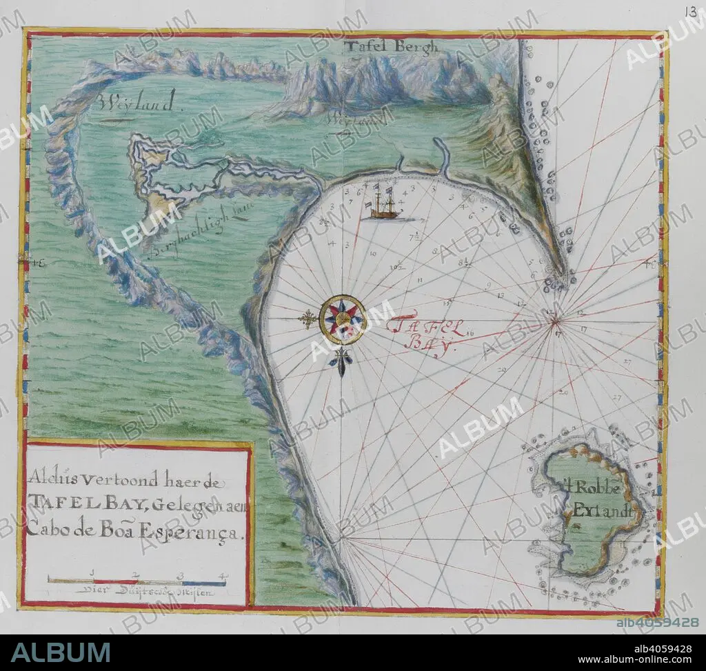
Map of the Cape of Good Hope. Table Bay, South Africa. DUTCH PORTOLANO, containing forty-nine coloured maps and views. 17th century. Source: Add. 34184, f.12.
| Partager |
|---|
 Pinterest Pinterest |
 Twitter Twitter |
 Facebook Facebook |
 Copier le lien Copier le lien |
 Email Email |
|
Ajouter à une autre Lightbox |
|
Ajouter à une autre Lightbox |


Avez-vous déjà un compte? S'identifier
Vous n'avez pas de compte ? S'inscrire
Acheter cette image.
Sélectionnez l'usage:

Légende: Voir la traduction automatique
Map of the Cape of Good Hope. Table Bay, South Africa. DUTCH PORTOLANO, containing forty-nine coloured maps and views. 17th century. Source: Add. 34184, f.12.
Map of the Cape of Good Hope. Table Bay, South Africa. DUTCH PORTOLANO, containing forty-nine coloured maps and views. 17th century. Source: Add. 34184, f.12.
Crédit: Album / British Library
Autorisations: ? Autorisation de modèle: Non - ? Autorisation de propriété: Non
Questions sur les droits?
Questions sur les droits?
Taille de l'image: 4291 × 3857 px | 47.4 MB
Taille d'impression: 36.3 × 32.7 cm | 1689.4 × 1518.5 in (300 dpi)
Mots clés: 17E SIECLE • 17EME S • AFRIQUE DU SUD • AFRIQUE • CARTE (GEOGRAPHIE) • CARTE GEOGRAPHIQUE • CARTE • CARTOGRAPHIE • DESSIN PLANS • DIX-SEPTIÈME SIÈCLE • PLAN (CARTOGRAPHIE) • PLANS • SCIENCE: CARTOGRAPHIE • XVIIE SIECLE
