alb6092268
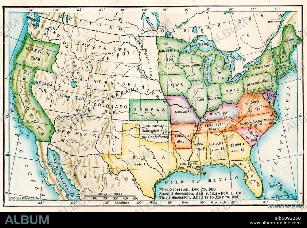
US map showing seceding states by date,
| Partager |
|---|
 Pinterest Pinterest |
 Twitter Twitter |
 Facebook Facebook |
 Copier le lien Copier le lien |
 Email Email |
|
Ajouter à une autre Lightbox |
|
Ajouter à une autre Lightbox |


Avez-vous déjà un compte? S'identifier
Vous n'avez pas de compte ? S'inscrire
Acheter cette image.
Sélectionnez l'usage:

Titre: US map showing seceding states by date,
Légende: Voir la traduction automatique
US map showing seceding states by date, American Civil War, 1860 and 1861. Printed color lithograph 19th century
US map showing seceding states by date, American Civil War, 1860 and 1861. Printed color lithograph 19th century
Crédit: Album / akg/North Wind Picture Archives
Autorisations: ? Autorisation de modèle: Non - ? Autorisation de propriété: Non
Questions sur les droits?
Questions sur les droits?
Taille de l'image: 3364 × 2326 px | 22.4 MB
Taille d'impression: 28.5 × 19.7 cm | 1324.4 × 915.7 in (300 dpi)
Mots clés: AMERIQUE DU NORD • ART (CATÉGORIE) • ART • CARTE (GEOGRAPHIE) • CARTE GEOGRAPHIQUE • CARTE • DESSIN PLANS • ETATS-UNIS D'AMERIQUE (USA) • ETATS-UNIS D'AMERIQUE • GUERRE CIVILE • GUERRE • HISOIRE • HISTOIRE • ILLUSTRATION • PHOTOGRAPHIE • PLAN (CARTOGRAPHIE) • PLANS • SUD • UNITED STATES OF AMERICA • USA • XIXE SIÈCLE
