alb9410906
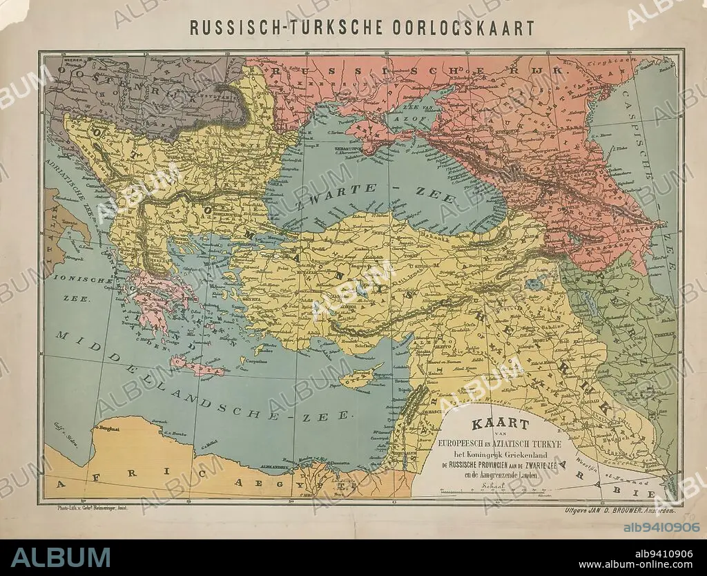
Map of the Russo-Turkish War, 1828, Russo-Turkish War Map / Map of Europeesch and Aziatsch Turkye the Kingdom of Greece the Russian Provinces on the Black Sea and the Adjacent Countries (title on object), Dutch map of Southeastern Europe, the battleground of the Russo-Turkish War, 1828., print maker: Gebroeders Reimeringer, (mentioned on object), publisher: Jan Dirk Brouwer, (mentioned on object), Amsterdam, 1828 - 1829, paper, photolithography, height 460 mm × width 605 mm.
| Partager |
|---|
 Pinterest Pinterest |
 Twitter Twitter |
 Facebook Facebook |
 Copier le lien Copier le lien |
 Email Email |
|
Ajouter à une autre Lightbox |
|
Ajouter à une autre Lightbox |


Avez-vous déjà un compte? S'identifier
Vous n'avez pas de compte ? S'inscrire
Acheter cette image.
Sélectionnez l'usage:

Légende:
Voir la traduction automatique
Map of the Russo-Turkish War, 1828, Russo-Turkish War Map / Map of Europeesch and Aziatsch Turkye the Kingdom of Greece the Russian Provinces on the Black Sea and the Adjacent Countries (title on object), Dutch map of Southeastern Europe, the battleground of the Russo-Turkish War, 1828., print maker: Gebroeders Reimeringer, (mentioned on object), publisher: Jan Dirk Brouwer, (mentioned on object), Amsterdam, 1828 - 1829, paper, photolithography, height 460 mm × width 605 mm
Crédit:
Album / quintlox
Autorisations:
Taille de l'image:
5000 x 3814 px | 54.6 MB
Taille d'impression:
42.3 x 32.3 cm | 16.7 x 12.7 in (300 dpi)
Mots clés:
AMSTERDAM • CARTE (GEOGRAPHIE) • CARTE GEOGRAPHIQUE • CARTE • CHAMP BATAILLE • CHAMP DE BATAILLE • DESSIN PLANS • GRECE • OBJET • PAPIER • PLAN (CARTOGRAPHIE) • PLANS • ROYAUME • ROYAUTÉ
