alb3298411
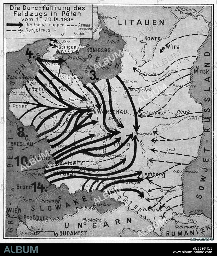
A map showing the execution of the German Campaign in Poland from the 1st to the 20th of September 1939.
| Partager |
|---|
 Pinterest Pinterest |
 Twitter Twitter |
 Facebook Facebook |
 Copier le lien Copier le lien |
 Email Email |
|
Ajouter à une autre Lightbox |
|
Ajouter à une autre Lightbox |


Avez-vous déjà un compte? S'identifier
Vous n'avez pas de compte ? S'inscrire
Acheter cette image.
Sélectionnez l'usage:

Légende:
Voir la traduction automatique
A map showing the execution of the German Campaign in Poland from the 1st to the 20th of September 1939
Crédit:
Album / Universal Images Group / Past Pix / Science & Society Picture Library
Autorisations:
Modèle: Non - Propriété: Non
Questions sur les droits?
Questions sur les droits?
Taille de l'image:
3525 x 3941 px | 39.7 MB
Taille d'impression:
29.8 x 33.4 cm | 11.8 x 13.1 in (300 dpi)
Mots clés:
1939-1945 • 3E REICH • ALLEMAND • ALLEMANDE • APRES-GUERRE: POLOGNE • ASSAULT • ASSAUT • ATTAQUE • ATTAQUES • CARTE (GEOGRAPHIE) • CARTE GEOGRAPHIQUE • CARTE • CHIRURGIE • COMMUNISME: POLOGNE • DESSIN PLANS • DEUXIEME GUERRE MONDIALE • FRONT DE L'EST • GEOGRAPHIE • GUERRE MONDIALE II • GUERRE • IIIE REICH • INVASION • MEDECINE CHIRURGIE • OFFENSIVE • OPERATION MEDICALE • OPERATION • PLAN (CARTOGRAPHIE) • PLAN • PLANS • POLOGNE • POLOGNE, COMMUNISME • SECONDE GUERRE MONDIALE • STRATEGIE • TROISIEME REICH • WEHRMACHT
