alb3545996
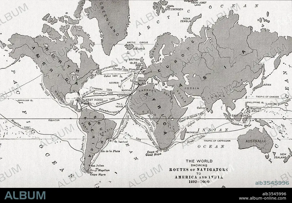
Map of the world showing the routes of navigators to America and India from 1492-1600
| Partager |
|---|
 Pinterest Pinterest |
 Twitter Twitter |
 Facebook Facebook |
 Copier le lien Copier le lien |
 Email Email |
|
Ajouter à une autre Lightbox |
|
Ajouter à une autre Lightbox |


Avez-vous déjà un compte? S'identifier
Vous n'avez pas de compte ? S'inscrire
Acheter cette image.
Sélectionnez l'usage:

Titre:
Map of the world showing the routes of navigators to America and India from 1492-1600
Légende:
Voir la traduction automatique
Map of the world showing the routes of navigators to America and India from 1492-1600. From The History of Our Country, published 1899
Crédit:
Album / Universal Images Group / Universal History Archive
Autorisations:
Taille de l'image:
5220 x 3355 px | 50.1 MB
Taille d'impression:
44.2 x 28.4 cm | 17.4 x 11.2 in (300 dpi)
Mots clés:
15 15E 15EME XV XVE XVEME SIECLE • 15E SIECLE • 15EME S • 16E SIECLE • 16EME S • AMÉRCAIN • AMERICAIN (ETATS-UNIS) • AMERICAIN (USA) • AMÉRICAIN • AMÉRICAINE • AMÉRICIAN • AMÉRICIANE • AMERIQUE • AMERIQUE, CONTINENT • CARTE (GEOGRAPHIE) • CARTE GEOGRAPHIQUE • CARTE • CONTINENT AMERIQUE • DÉCOUVERTE • DESSIN PLANS • ÉTAS UNIS • ÉTAS-UNIS • ETATS UNIS • ETATS-UNIS • EXPLORATION • GEOGRAPHIE • INDE • INDES • MONDE • NAVIGATION • PAYS • PLAN (CARTOGRAPHIE) • PLANS • QUINZIÈME SIÈCLE • SEIZIÈME SIÈCLE • U. S. A. • XVE SIECLE • XVIE SIECLE • ŽTATS-UNIS
