alb3988176
Map of Aldgate Ward, City of London, 1739. Artist: RW Seale
| Partager |
|---|
 Pinterest Pinterest |
 Twitter Twitter |
 Facebook Facebook |
 Copier le lien Copier le lien |
 Email Email |
|
Ajouter à une autre Lightbox |
|
Ajouter à une autre Lightbox |


Avez-vous déjà un compte? S'identifier
Vous n'avez pas de compte ? S'inscrire
Acheter cette image.
Sélectionnez l'usage:

Titre: Map of Aldgate Ward, City of London, 1739. Artist: RW Seale
Légende: Voir la traduction automatique
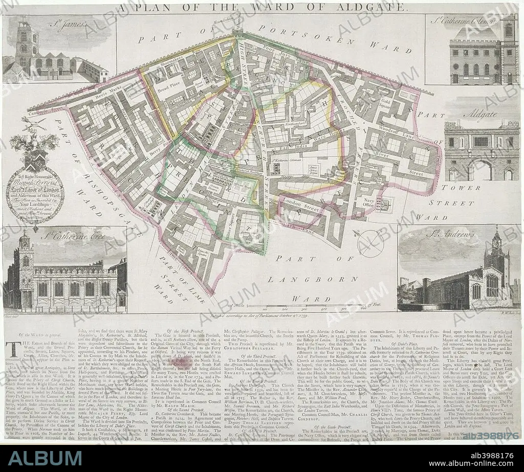
Map of Aldgate Ward, City of London, 1739. With images in the margins of Aldgate and four ward churches: St James, Duke Street, St Katherine Cree, St Katherine Coleman and St Andrew Undershaft. Below is a description of the ward.
Map of Aldgate Ward, City of London, 1739. With images in the margins of Aldgate and four ward churches: St James, Duke Street, St Katherine Cree, St Katherine Coleman and St Andrew Undershaft. Below is a description of the ward.
Personnalités: JACOB
Crédit: Album / The London Archives (City of London)/Heritage Images
Autorisations: ? Autorisation de modèle: Non - ? Autorisation de propriété: Non
Questions sur les droits?
Questions sur les droits?
Taille de l'image: 2718 × 2310 px | 18.0 MB
Taille d'impression: 23.0 × 19.6 cm | 1070.1 × 909.4 in (300 dpi)
Mots clés: 18 18E 18EME XVIII XVIIIE XVIIIEME SIECLE • 18E SIECLE • 18EME S • ANGLETERRE • CHRISTIANISME • COULEUR • DIX-HUITIÈME SIÈCLE • ECCLESIA • EGLISE • EGLISE, INTERIEUR • ÉGLISES • INTERIEUR: EGLISE • JACOB • RELIGION • XVIIIE SIECLE
