alb12105471
Map of Englewood
| Partager |
|---|
 Pinterest Pinterest |
 Twitter Twitter |
 Facebook Facebook |
 Copier le lien Copier le lien |
 Email Email |
|
Ajouter à une autre Lightbox |
|
Ajouter à une autre Lightbox |


Avez-vous déjà un compte? S'identifier
Vous n'avez pas de compte ? S'inscrire
Acheter cette image.
Sélectionnez l'usage:

Titre: Map of Englewood
Légende: Voir la traduction automatique
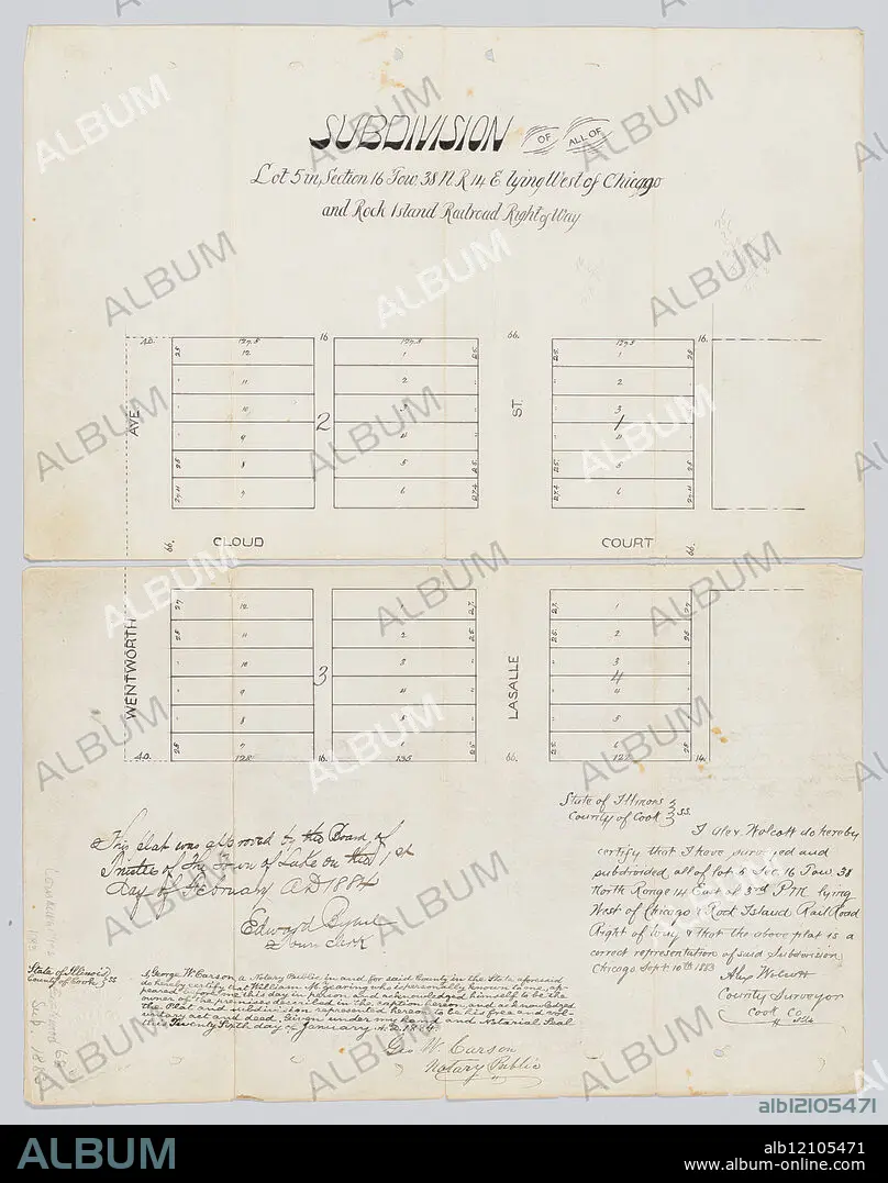
Map of Englewood, Chicago, Illinois, 1883. View of Wentworth Avenue and LaSalle Street immediately north and south of Cloud Court. Handwritten record of approval by Board of Trustees of Town of Lake by Edward Bybel, town clerk, February 1, 1884; handwritten certification of accuracy by Alex Wolcott, county surveyor, September 10, 1883; handwritten certification of William M. Zearing as owner of land by Geo. W. Carson, notary public, January 26, 1884.
Map of Englewood, Chicago, Illinois, 1883. View of Wentworth Avenue and LaSalle Street immediately north and south of Cloud Court. Handwritten record of approval by Board of Trustees of Town of Lake by Edward Bybel, town clerk, February 1, 1884; handwritten certification of accuracy by Alex Wolcott, county surveyor, September 10, 1883; handwritten certification of William M. Zearing as owner of land by Geo. W. Carson, notary public, January 26, 1884.
Crédit: Album / Chicago History Museum / TopFoto
Autorisations: ? Autorisation de modèle: Non - ? Autorisation de propriété: Non
Questions sur les droits?
Questions sur les droits?
Taille de l'image: 4502 × 5706 px | 73.5 MB
Taille d'impression: 38.1 × 48.3 cm | 1772.4 × 2246.5 in (300 dpi)
