alb3810254
Africa Map Areas of Slave Trade, 1850
| Partager |
|---|
 Pinterest Pinterest |
 Twitter Twitter |
 Facebook Facebook |
 Copier le lien Copier le lien |
 Email Email |
|
Ajouter à une autre Lightbox |
|
Ajouter à une autre Lightbox |


Avez-vous déjà un compte? S'identifier
Vous n'avez pas de compte ? S'inscrire
Acheter cette image.
Sélectionnez l'usage:

Titre: Africa Map Areas of Slave Trade, 1850
Légende: Voir la traduction automatique
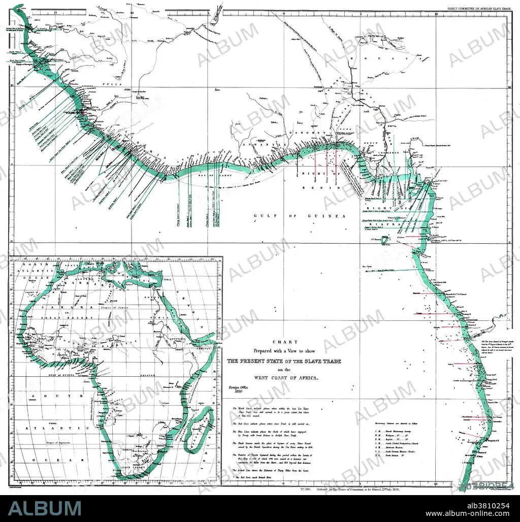
"The Present State of the Slave Trade on the West Coast of Africa," 1850. A map of the west coast of Africa showing areas of slave trade during the early 19th century. The map denotes areas of missionary work and capture of slave ships by British vessels. Inset of African continent. Created by John Arrowsmith of the Select Committee on African Slave Trade.
"The Present State of the Slave Trade on the West Coast of Africa," 1850. A map of the west coast of Africa showing areas of slave trade during the early 19th century. The map denotes areas of missionary work and capture of slave ships by British vessels. Inset of African continent. Created by John Arrowsmith of the Select Committee on African Slave Trade.
Crédit: Album / Science Source / Smithsonian Libraries
Autorisations: ? Autorisation de modèle: Non - ? Autorisation de propriété: Non
Questions sur les droits?
Questions sur les droits?
Taille de l'image: 4170 × 3971 px | 47.4 MB
Taille d'impression: 35.3 × 33.6 cm | 1641.7 × 1563.4 in (300 dpi)
Mots clés: AFRIQUE • COLONIALISME • COMMERCE D'ESCLAVES • ESCLAVAGE • IMPERIALISME • TERROIR • TRAFIC D'HOMMES
