alb1962068
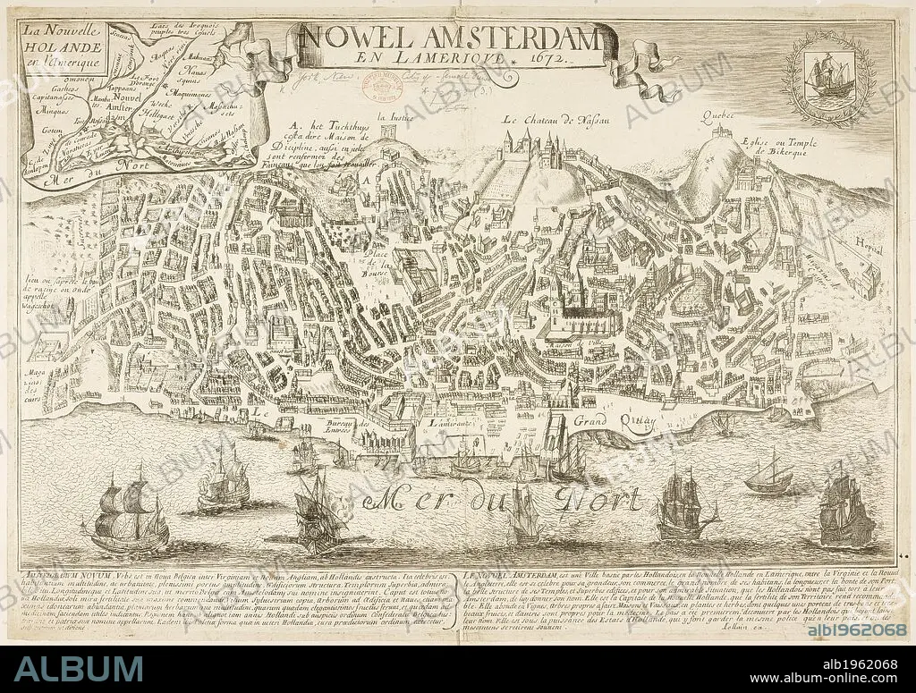
Map of New Amsterdam (New York) in 1672 and then in 1729, showing 88 years of growth. . Nowel Amsterdam 1729. New York, USA. Actual Map and Comparative Plans showing 88 years growth of the City of New York, by D. Longworth. (Plan of New York in 1729, surveyed by I. Lyne). Publisher/year :New York, 1817. Source: Maps.73953 (3).
| Partager |
|---|
 Pinterest Pinterest |
 Twitter Twitter |
 Facebook Facebook |
 Copier le lien Copier le lien |
 Email Email |
|
Ajouter à une autre Lightbox |
|
Ajouter à une autre Lightbox |


Avez-vous déjà un compte? S'identifier
Vous n'avez pas de compte ? S'inscrire
Acheter cette image.
Sélectionnez l'usage:

Légende:
Voir la traduction automatique
Map of New Amsterdam (New York) in 1672 and then in 1729, showing 88 years of growth. . Nowel Amsterdam 1729. New York, USA. Actual Map and Comparative Plans showing 88 years growth of the City of New York, by D. Longworth. (Plan of New York in 1729, surveyed by I. Lyne). Publisher/year :New York, 1817. Source: Maps.73953 (3).
Crédit:
Album / British Library
Autorisations:
Taille de l'image:
7144 x 5038 px | 103.0 MB
Taille d'impression:
60.5 x 42.7 cm | 23.8 x 16.8 in (300 dpi)
Mots clés:
18 18E 18EME XVIII XVIIIE XVIIIEME SIECLE • 18E SIECLE • 18EME S • AMERICAIN (ETATS-UNIS) • AMERICAIN (USA) • CARTE (GEOGRAPHIE) • CARTE GEOGRAPHIQUE • CARTE • CARTOGRAPHIE • CITE • DESSIN PLANS • DIX-HUITIÈME SIÈCLE • ÉTAS UNIS • ÉTAS-UNIS • ETATS UNIS • ETATS-UNIS • NEW YORK • NEW YORK, ETATS-UNIS • NEW-YORK • PLAN (CARTOGRAPHIE) • PLANS • SCIENCE: CARTOGRAPHIE • U. S. A. • VILE • VILLE • XVIIIE SIECLE • ŽTATS-UNIS
