alb9215449
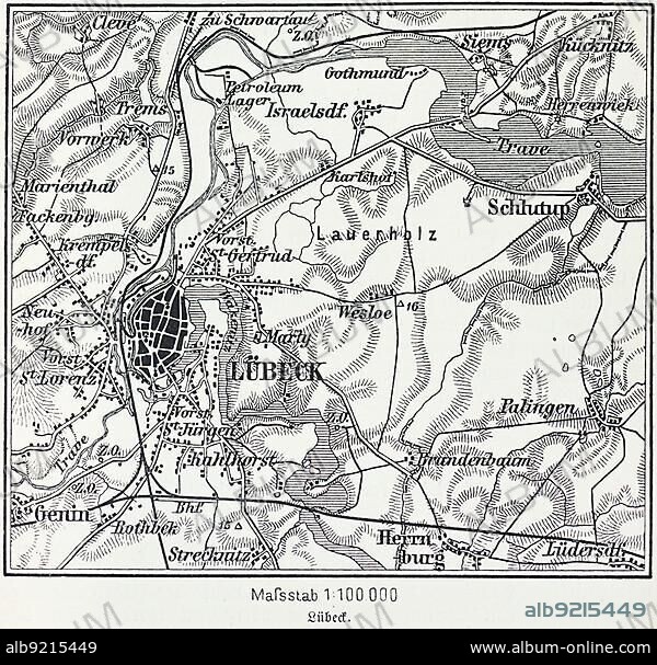
City map of Lübeck, Hanseatic city, Schleswig-Holstein, Germany, Trave, Baltic Sea, districts, Schlutup, St. Lorenz, map, cartography, railway lines, surrounding area, historical illustration 19th century, Europe.
| Partager |
|---|
 Pinterest Pinterest |
 Twitter Twitter |
 Facebook Facebook |
 Copier le lien Copier le lien |
 Email Email |
|
Ajouter à une autre Lightbox |
|
Ajouter à une autre Lightbox |


Avez-vous déjà un compte? S'identifier
Vous n'avez pas de compte ? S'inscrire
Acheter cette image.
Sélectionnez l'usage:

Légende:
Voir la traduction automatique
City map of Lübeck, Hanseatic city, Schleswig-Holstein, Germany, Trave, Baltic Sea, districts, Schlutup, St. Lorenz, map, cartography, railway lines, surrounding area, historical illustration 19th century, Europe
Crédit:
Album / ImageBroker / Wolfgang Diederich
Autorisations:
Modèle: Non - Propriété: Non
Questions sur les droits?
Questions sur les droits?
Taille de l'image:
600 x 574 px | 1009.0 KB
Taille d'impression:
5.1 x 4.9 cm | 2.0 x 1.9 in (300 dpi)
Mots clés:
