alb5366686
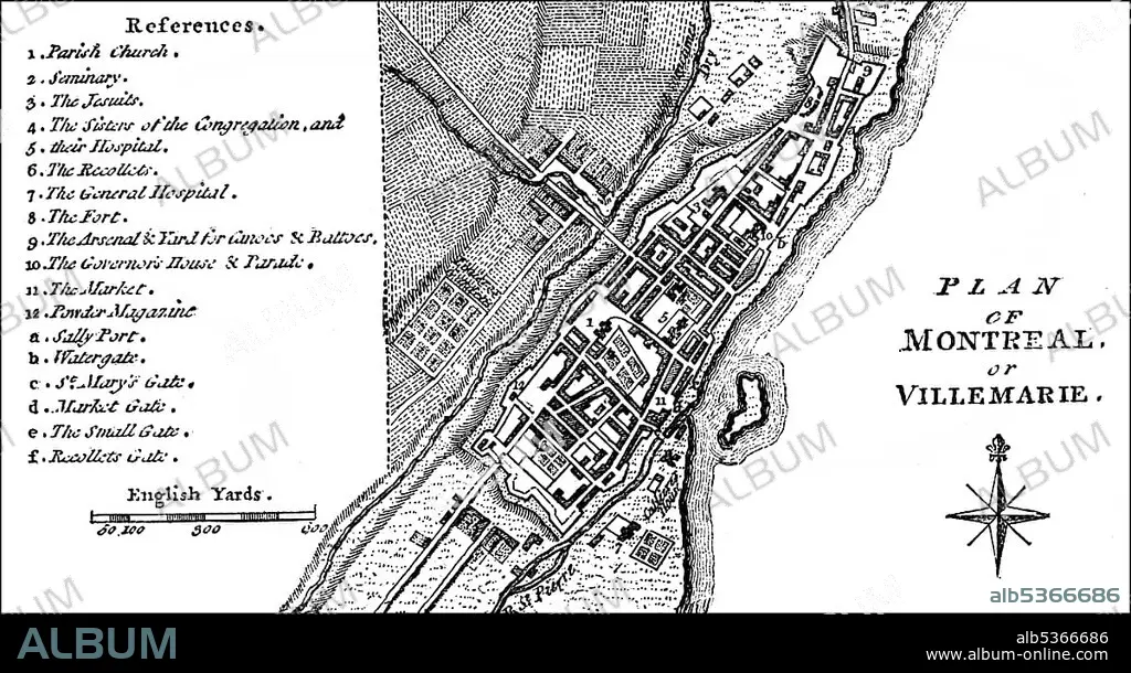
City map of the city of Montreal, Quebec, Canada, around 1760, North America.
| Partager |
|---|
 Pinterest Pinterest |
 Twitter Twitter |
 Facebook Facebook |
 Copier le lien Copier le lien |
 Email Email |
|
Ajouter à une autre Lightbox |
|
Ajouter à une autre Lightbox |


Avez-vous déjà un compte? S'identifier
Vous n'avez pas de compte ? S'inscrire
Acheter cette image.
Sélectionnez l'usage:

Légende: Voir la traduction automatique
City map of the city of Montreal, Quebec, Canada, around 1760, North America
City map of the city of Montreal, Quebec, Canada, around 1760, North America
Crédit: Album / ImageBroker / H.-D. Falkenstein
Autorisations: ? Autorisation de modèle: Non - ? Autorisation de propriété: Non
Questions sur les droits?
Questions sur les droits?
Taille de l'image: 5670 × 3084 px | 50.0 MB
Taille d'impression: 48.0 × 26.1 cm | 2232.3 × 1214.2 in (300 dpi)
Mots clés: AMÉRICAIN • AMERIQUE • AMERIQUE, CONTINENT • CADRE • CANADA • CARTE • CARTES • CARTON • COLONIALISME • CONTINENT AMERIQUE • GEOGRAPHIE • IMAGES • INTERIEUR: TABLEAUX • PEINDRE • PEINTURE, SCENES D'INTERIE • PLAN DE VILLE • TABLEAU: SCENES D'INTERIEU • TABLEAUX
