alb1642133
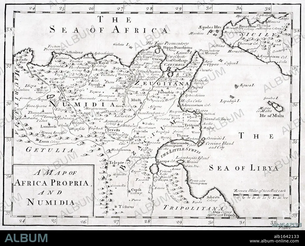
A 19th century Map of Africa Propria and Numidia.
| Partager |
|---|
 Pinterest Pinterest |
 Twitter Twitter |
 Facebook Facebook |
 Copier le lien Copier le lien |
 Email Email |
|
Ajouter à une autre Lightbox |
|
Ajouter à une autre Lightbox |


Avez-vous déjà un compte? S'identifier
Vous n'avez pas de compte ? S'inscrire
Acheter cette image.
Sélectionnez l'usage:

Légende:
Voir la traduction automatique
A 19th century Map of Africa Propria and Numidia
Crédit:
Album / Universal History Archive/Universal Images Group
Autorisations:
Modèle: Non - Propriété: Non
Questions sur les droits?
Questions sur les droits?
Taille de l'image:
4988 x 3767 px | 53.8 MB
Taille d'impression:
42.2 x 31.9 cm | 16.6 x 12.6 in (300 dpi)
Mots clés:
AFRICAIN • AFRICAINE • AFRIQUE • CARTE (GEOGRAPHIE) • CARTE GEOGRAPHIQUE • CARTE • CARTOGRAPHIE • DESSIN PLANS • FRAVURE • GRAVURE • HORIZONTALE • ILLUSTRATION • KEN • MALTE • MER • NOIR ET BLANC • NORD • OCEAN • PAYSAGE MARITIME • PLAN (CARTOGRAPHIE) • PLANS • SCIENCE: CARTOGRAPHIE • SICILE • XIXE SIÈCLE
