alb5482962
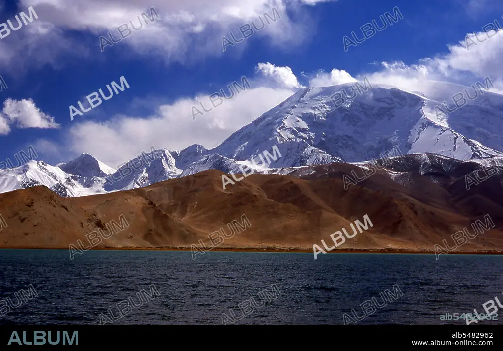
China: Muztagh Ata (Ice Mountain Father) next to Lake Karakul on the Karakoram Highway, Xinjiang
| Partager |
|---|
 Pinterest Pinterest |
 Twitter Twitter |
 Facebook Facebook |
 Copier le lien Copier le lien |
 Email Email |
|
Ajouter à une autre Lightbox |
|
Ajouter à une autre Lightbox |


Avez-vous déjà un compte? S'identifier
Vous n'avez pas de compte ? S'inscrire
Acheter cette image.
Sélectionnez l'usage:

Titre:
China: Muztagh Ata (Ice Mountain Father) next to Lake Karakul on the Karakoram Highway, Xinjiang
Légende:
Voir la traduction automatique
Muztagh Ata, or Muztagata (Uyghur: 'ice-mountain-father'), is the second highest (7546 metres) of the mountains which form the northern edge of the Tibetan Plateau (not the second highest of the mountains of the Tibetan Plateau). It is sometimes regarded as being part of the Kunlun Shan, although physically it is more closely connected to the Pamirs. It is also reputedly one of the easiest 7,000 m peaks in the world to climb, due to its gentle western slope and the comparatively drier weather of Xinjiang. The Zhongba Gonglu or Karakoram Highway is an engineering marvel that was opened in 1986 and remains the highest paved road in the world. It connects China and Pakistan across the Karakoram mountain range, through the Khunjerab Pass, at an altitude of 4,693 m/15,397 ft.
Crédit:
Album / Pictures From History/Universal Images Group
Autorisations:
Modèle: Non - Propriété: Non
Questions sur les droits?
Questions sur les droits?
Taille de l'image:
5125 x 3307 px | 48.5 MB
Taille d'impression:
43.4 x 28.0 cm | 17.1 x 11.0 in (300 dpi)
Mots clés:
ASIE • ASIE, CONTINENT • CHAINE DE MONTAGNES • CHINE • CHINOIS • CHINOISE • CONTINENT ASIE • CORDILLÈRE • HISOIRE • HISTOIRE • MASSIF • MONT • MONTAGNE • MONTAGNES • TRANSPORT
