alb9831162
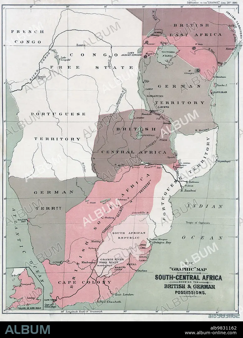
Map of south-Central Africa showing British and German possessions in the 1890s. After a map published in the June 25th, 1890 edition of The Graphic. The inset map, lower left, shows England on the same scale as the African map.
| Partager |
|---|
 Pinterest Pinterest |
 Twitter Twitter |
 Facebook Facebook |
 Copier le lien Copier le lien |
 Email Email |
|
Ajouter à une autre Lightbox |
|
Ajouter à une autre Lightbox |


Avez-vous déjà un compte? S'identifier
Vous n'avez pas de compte ? S'inscrire
Acheter cette image.
Sélectionnez l'usage:

Légende: Voir la traduction automatique
Map of south-Central Africa showing British and German possessions in the 1890s. After a map published in the June 25th, 1890 edition of The Graphic. The inset map, lower left, shows England on the same scale as the African map.
Map of south-Central Africa showing British and German possessions in the 1890s. After a map published in the June 25th, 1890 edition of The Graphic. The inset map, lower left, shows England on the same scale as the African map.
Crédit: Album / Ken Welsh/Universal History Archive/Universal Images Group
Autorisations: ? Autorisation de modèle: Non - ? Autorisation de propriété: Non
Questions sur les droits?
Questions sur les droits?
Taille de l'image: 4029 × 5315 px | 61.3 MB
Taille d'impression: 34.1 × 45.0 cm | 1586.2 × 2092.5 in (300 dpi)
Mots clés: AFRIQUE • ALLEMAGNE • ALLEMAND • ALLEMANDE • ANGALIS • ANGLAIS • ANGLAISE • ANGLETARRE • ANGLETERE • ANGLETERRE • ARCHIVE • BLANC • BLANCHE • CARTE • CARTOGRAPHIE • COLONIALISME • COLONIE • DETENTION • GEOGRAPHIE • GRANDE BERTAGNE • GRANDE BRETAGNE • GRANDE-BRETAGNE • HISOIRE • HISTOIRE • ILLUSTRATION • INGLATERRA • NOIR • POSSESSION • ROYAUME UNI • ROYAUME-UNI • SCIENCE: CARTOGRAPHIE • XIXE SIÈCLE
