alb9226744
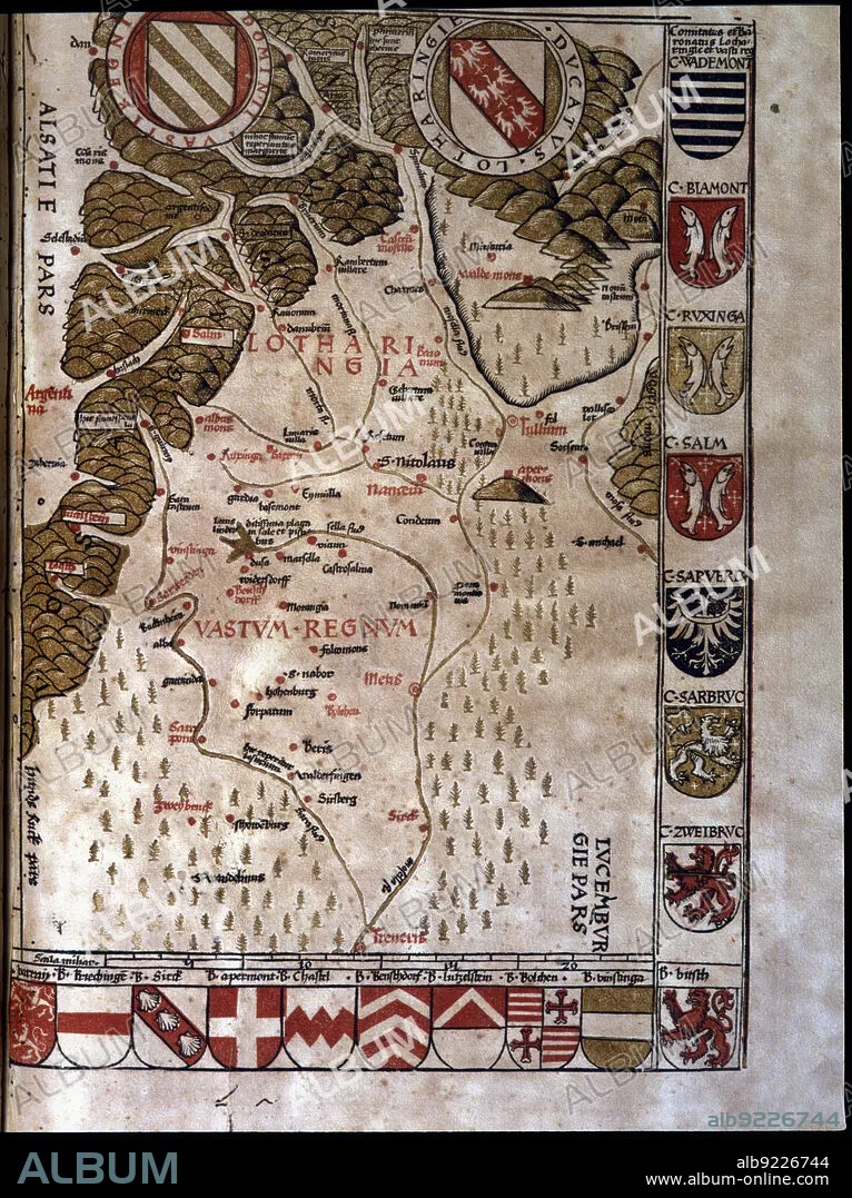
Map of the Duchy of Lotaringia, now Lorraine (France), 1596. Creator: Ptolomeo, Claudio. (90-168).
| Partager |
|---|
 Pinterest Pinterest |
 Twitter Twitter |
 Facebook Facebook |
 Copier le lien Copier le lien |
 Email Email |
|
Ajouter à une autre Lightbox |
|
Ajouter à une autre Lightbox |


Avez-vous déjà un compte? S'identifier
Vous n'avez pas de compte ? S'inscrire
Acheter cette image.
Sélectionnez l'usage:

Titre:
Map of the Duchy of Lotaringia, now Lorraine (France), 1596. Creator: Ptolomeo, Claudio. (90-168).
Légende:
Voir la traduction automatique
Map of the Duchy of Lotaringia, now Lorraine (France). In'Geographiae Universae', 1596.
Crédit:
Album / Index/Heritage Images
Autorisations:
Taille de l'image:
4865 x 6507 px | 90.6 MB
Taille d'impression:
41.2 x 55.1 cm | 16.2 x 21.7 in (300 dpi)
Mots clés:
16E SIECLE • 16EME S • COLLÈGE • COULEUR • EDUCATION UNIVERSITE • ESPAGNE • LORRAINE • SEIZIÈME SIÈCLE • UNIVERSITE • UNIVERSITES • XVIE SIECLE
