alb5475616
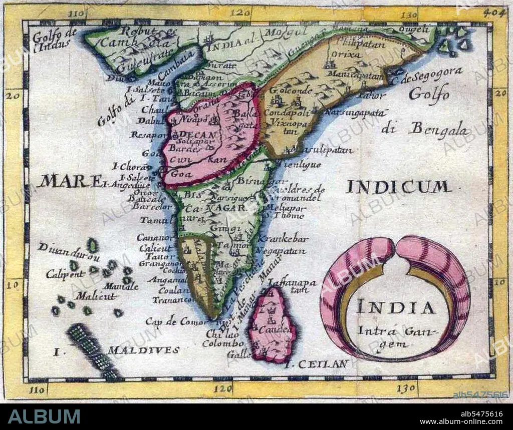
India Intra-Gangem', a miniature map of the Malabar and Coromandel coasts.
| Partager |
|---|
 Pinterest Pinterest |
 Twitter Twitter |
 Facebook Facebook |
 Copier le lien Copier le lien |
 Email Email |
|
Ajouter à une autre Lightbox |
|
Ajouter à une autre Lightbox |


Avez-vous déjà un compte? S'identifier
Vous n'avez pas de compte ? S'inscrire
Acheter cette image

Titre:
India Intra-Gangem', a miniature map of the Malabar and Coromandel coasts.
Légende:
Voir la traduction automatique
In classical usage, 'India Intra Gangem' refers to South Asia west of the Ganges, while 'India Extra Gangem' refers to peninsular Southeast Asia.
Crédit:
Album / Pictures From History/Universal Images Group
Autorisations:
Modèle: Non - Propriété: Non
Questions sur les droits?
Questions sur les droits?
Taille de l'image:
4380 x 3449 px | 43.2 MB
Taille d'impression:
37.1 x 29.2 cm | 14.6 x 11.5 in (300 dpi)
Mots clés:
ASIE • ASIE, CONTINENT • CARTE (GEOGRAPHIE) • CARTE GEOGRAPHIQUE • CARTE • CONTINENT ASIE • DESSIN PLANS • HISOIRE • HISTOIRE • INDE • INDES • INDIEN • INDIENNE • INDIENS • PLAN (CARTOGRAPHIE) • PLANS • SRI LANKA • TAMIL NADU
