alb3970406
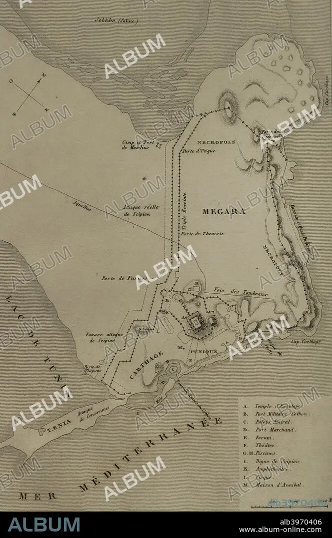
Map of Carthage and the Peninsula. Engraving. Panorama Universal. History of Carthage, 1850.
| Partager |
|---|
 Pinterest Pinterest |
 Twitter Twitter |
 Facebook Facebook |
 Copier le lien Copier le lien |
 Email Email |
|
Ajouter à une autre Lightbox |
|
Ajouter à une autre Lightbox |


Avez-vous déjà un compte? S'identifier
Vous n'avez pas de compte ? S'inscrire
Acheter cette image

Légende:
Voir la traduction automatique
Map of Carthage and the Peninsula. Engraving. Panorama Universal. History of Carthage, 1850.
Crédit:
Album / Prisma
Autorisations:
Modèle: Non - Propriété: Non
Questions sur les droits?
Questions sur les droits?
Taille de l'image:
2953 x 4554 px | 38.5 MB
Taille d'impression:
25.0 x 38.6 cm | 9.8 x 15.2 in (300 dpi)
Mots clés:
AFRICAIN • AFRICAINE • AFRIQUE DU NORD • AFRIQUE • ARCHÉLOGIE • ARCHEOLOGIE SITES • ARCHEOLOGIE • ARCHÉOLOLOGIE • CARTAGO • CARTE (GEOGRAPHIE) • CARTE GEOGRAPHIQUE • CARTE • CARTOGRAPHIE • CHAMP DE TOMBES • DELABREMENT • DESSIN PLANS • FRAVURE • GRAVURE • HISOIRE • HISTOIRE • MÉDITERRANÉE • NÉCROPOLE • PÉNINSULE • PLAN (CARTOGRAPHIE) • PLANS • PRESQU'ILE • RUINE • RUINES • SCIENCE: CARTOGRAPHIE • SITES ARCHEOLOGIQUES • XIXE SIÈCLE
