alb4075494
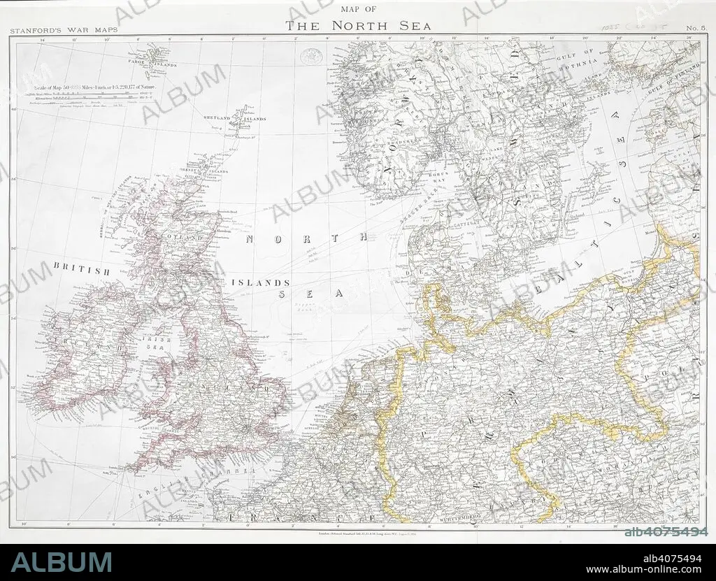
First World War map of the North Sea, 1914. Stanford's War Maps. No. 5. Map of the North Sea. Scale 50,8235 miles - 1 inch, or 1:3,220,177 of nature. London, 12 August 1914. Source: Maps.1035.(90) no.5.
| Partager |
|---|
 Pinterest Pinterest |
 Twitter Twitter |
 Facebook Facebook |
 Copier le lien Copier le lien |
 Email Email |
|
Ajouter à une autre Lightbox |
|
Ajouter à une autre Lightbox |


Avez-vous déjà un compte? S'identifier
Vous n'avez pas de compte ? S'inscrire
Acheter cette image

Légende:
Voir la traduction automatique
First World War map of the North Sea, 1914. Stanford's War Maps. No. 5. Map of the North Sea. Scale 50,8235 miles - 1 inch, or 1:3,220,177 of nature. London, 12 August 1914. Source: Maps.1035.(90) no.5.
Crédit:
Album / British Library
Autorisations:
Modèle: Non - Propriété: Non
Questions sur les droits?
Questions sur les droits?
Taille de l'image:
7886 x 5993 px | 135.2 MB
Taille d'impression:
66.8 x 50.7 cm | 26.3 x 20.0 in (300 dpi)
Mots clés:
CARTE (GEOGRAPHIE) • CARTE GEOGRAPHIQUE • CARTE • CARTOGRAPHIE • DESSIN PLANS • ÉVÉNEMENT • GRANDE GUERRE • GUERRE 14-18 • GUERRE 1914-1918 • GUERRE MONDIALE I • GUERRE • PLAN (CARTOGRAPHIE) • PLANS • PREMIERE GUERRE MONDIALE (1914-1918) • PREMIERE GUERRE MONDIALE • SCIENCE: CARTOGRAPHIE • XXE SIECLE
