alb1962595
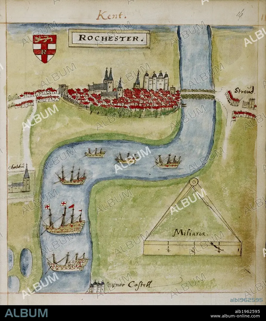
A coloured plan of Rochester, Kent. The River Medway is shown. . The Particular Description of England. 1588. Source: Sloane 2596 f.16.
| Partager |
|---|
 Pinterest Pinterest |
 Twitter Twitter |
 Facebook Facebook |
 Copier le lien Copier le lien |
 Email Email |
|
Ajouter à une autre Lightbox |
|
Ajouter à une autre Lightbox |


Avez-vous déjà un compte? S'identifier
Vous n'avez pas de compte ? S'inscrire
Acheter cette image.
Sélectionnez l'usage:

Légende:
Voir la traduction automatique
A coloured plan of Rochester, Kent. The River Medway is shown. . The Particular Description of England. 1588. Source: Sloane 2596 f.16.
Personnalités:
Crédit:
Album / British Library
Autorisations:
Modèle: Non - Propriété: Non
Questions sur les droits?
Questions sur les droits?
Taille de l'image:
5318 x 6114 px | 93.0 MB
Taille d'impression:
45.0 x 51.8 cm | 17.7 x 20.4 in (300 dpi)
Mots clés:
16E SIECLE • 16EME S • ANGLETARRE • ANGLETERE • ANGLETERRE • CARTE (GEOGRAPHIE) • CARTE GEOGRAPHIQUE • CARTE • CARTOGRAPHIE • DESSIN PLANS • DOCUMENT • GRANDE BERTAGNE • GRANDE BRETAGNE • GRANDE-BRETAGNE • INGLATERRA • KENT • PLAN (CARTOGRAPHIE) • PLAN • PLANS • ROYAUME UNI • ROYAUME-UNI • SCIENCE: CARTOGRAPHIE • SEIZIÈME SIÈCLE • XVIE SIECLE
